MyTopo
Pierce Oklahoma US Topo Map
Couldn't load pickup availability
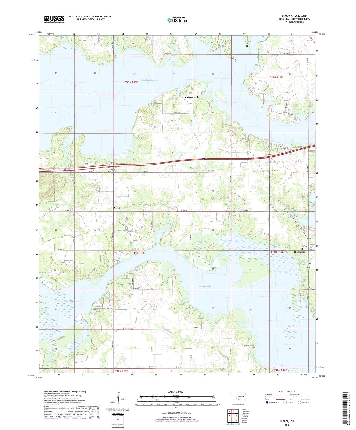
2018 topographic map quadrangle Pierce in the state of Oklahoma. Scale: 1:24000. Based on the newly updated USGS 7.5' US Topo map series, this map is in the following counties: McIntosh. The map contains contour data, water features, and other items you are used to seeing on USGS maps, but also has updated roads and other features. This is the next generation of topographic maps. Printed on high-quality waterproof paper with UV fade-resistant inks.
Quads adjacent to this one:
West: Hoffman
Northwest: Morris
North: Council Hill
Northeast: Wainwright
East: Checotah
Southeast: Eufaula
South: Stidham
Southwest: Raiford
Contains the following named places: Big Arbor Cemetery, Big Arbor Church, Brush Hill, Brush Hill Cemetery, Fountainhead Area Improvement Council Fire Department Brush Station, Fountainhead Area Improvement Council Fire Department Pierce, Galilee Church, Gentry Creek, Hitchita-Pierce Division, Lerblance Cemetery, McNik Cemetery, Paradise Point Fire Department, Pierce, Pierce Cemetery, Pierce High School, Richardsville, Sevenmile Slough, Sharper Creek, Snake Creek, Stidham School, Township of Turner, Vivian Area Fire Protection Association Stidham, Warrior School