MyTopo
Checotah Oklahoma US Topo Map
Couldn't load pickup availability
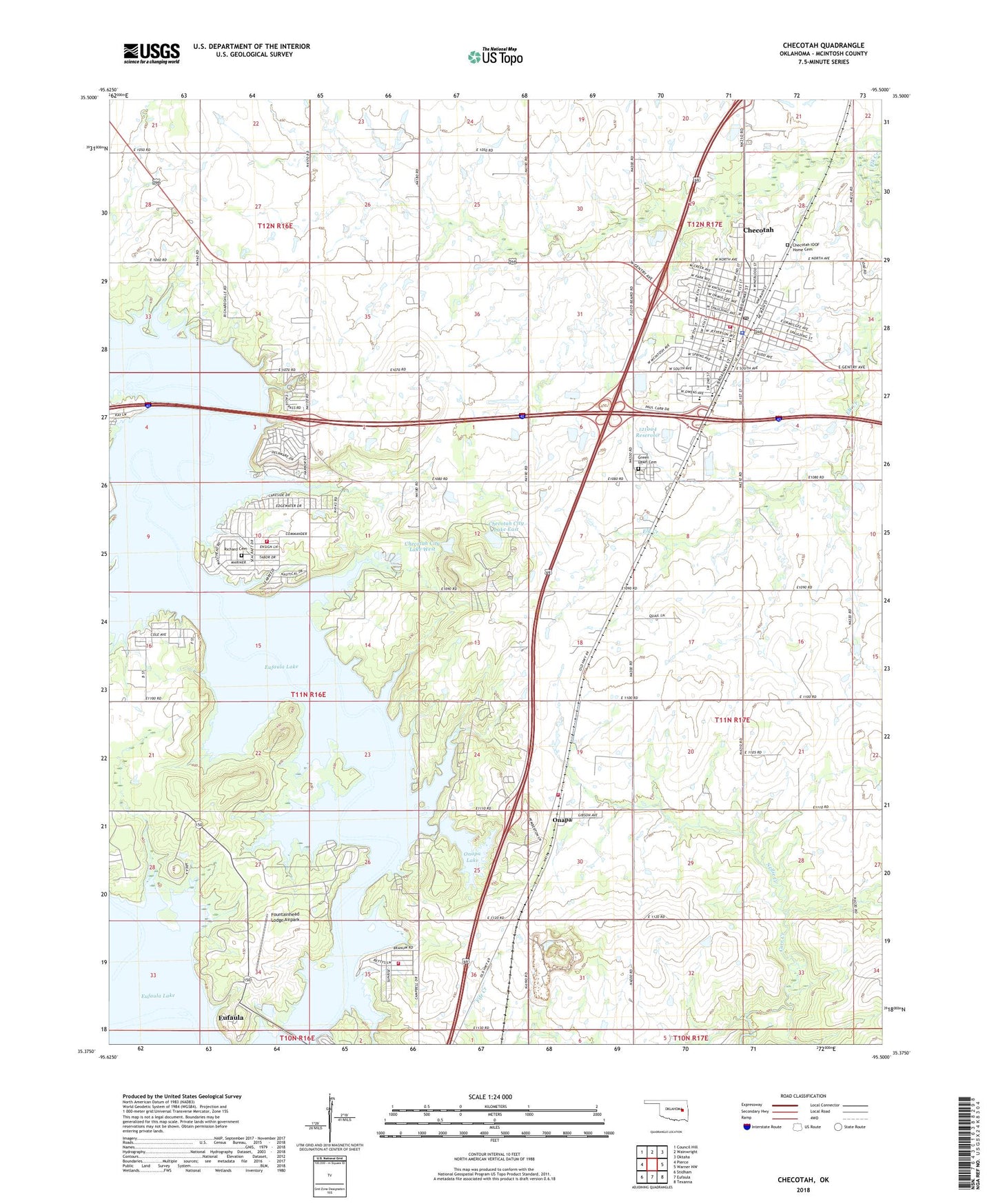
2023 topographic map quadrangle Checotah in the state of Oklahoma. Scale: 1:24000. Based on the newly updated USGS 7.5' US Topo map series, this map is in the following counties: McIntosh. The map contains contour data, water features, and other items you are used to seeing on USGS maps, but also has updated roads and other features. This is the next generation of topographic maps. Printed on high-quality waterproof paper with UV fade-resistant inks.
Quads adjacent to this one:
West: Pierce
Northwest: Council Hill
North: Wainwright
Northeast: Oktaha
East: Warner NW
Southeast: Texanna
South: Eufaula
Southwest: Stidham
This map covers the same area as the classic USGS quad with code o35095d5.
Contains the following named places: Bessie C Tabor Cemetery, Checotah, Checotah City Lake East, Checotah City Lake East Dam, Checotah City Lake West, Checotah City Lake West Dam, Checotah Emergency Ambulance Service, Checotah High School, Checotah Intermediate Elementary School, Checotah IOOF Home Cemetery, Checotah Middle School, Checotah Police Department, Checotah Post Office, Checotah Volunteer Fire Department, Church of Christ, City of Checotah, Deep Fork Church, First Baptist Church, First Free Will Baptist Church, Fountainhead Lodge Airpark, Fountainhead State Park, Green Lawn Cemetery, Indian Territory Checotah Cemetery, Longfellow Independent School, Lotawatah Volunteer Fire Department, Marshall Elementary School, Nellie Creek, North Canadian River, Oknoname 121004 Dam, Oknoname 121004 Reservoir, Oknoname 121005 Dam, Oknoname 121005 Reservoir, Onapa, Onapa Fire Department Station 1 Headquarters, Onapa Fire Department Station 2, Onapa Lake, Onapa Lake Dam, Richard Cemetery, Township of Checotah, Warner Lake, Warner Lake Dam, ZIP Code: 74426