MyTopo
Porum Oklahoma US Topo Map
Couldn't load pickup availability
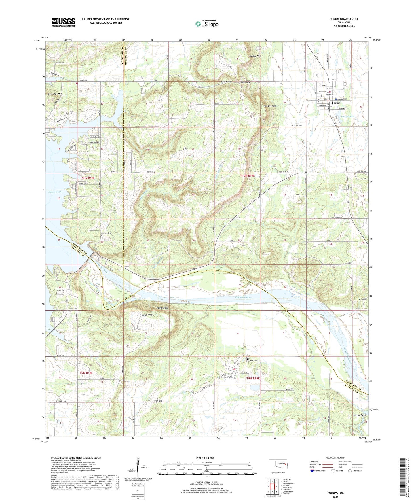
2018 topographic map quadrangle Porum in the state of Oklahoma. Scale: 1:24000. Based on the newly updated USGS 7.5' US Topo map series, this map is in the following counties: Muskogee, Haskell, McIntosh. The map contains contour data, water features, and other items you are used to seeing on USGS maps, but also has updated roads and other features. This is the next generation of topographic maps. Printed on high-quality waterproof paper with UV fade-resistant inks.
Quads adjacent to this one:
West: Texanna
Northwest: Warner NW
North: Warner
Northeast: Holt Mountain
East: Stigler West
Southeast: Sans Bois
South: Quinton North
Southwest: Enterprise
Contains the following named places: Asbury Cemetery, Belle Starr Creek, Black Haw Mountain, Brooken Creek, Buckner Cemetery, Coleman Cemetery, Eufaula Dam, Hensley Mountain, Hi Early Cemetery, Hi Early Mountain, Hoyt, Hoyt Cemetery, Hoyt Census Designated Place, Hoyt Volunteer Fire Department, Oknoname 101017 Dam, Oknoname 101017 Reservoir, Porum, Porum Elementary School, Porum Gap, Porum Junior High / High School, Porum Lake, Porum Lake Dam, Porum Landing Fire Protection Association, Porum Police Department, Porum Post Office, Porum Volunteer Fire Department, Sandy Ridge, Sandy Ridge School, Starr Cemetery, Tater Hill, Taylor Bluff, Town of Porum, Township of Porum, ZIP Code: 74455