MyTopo
Prague SW Oklahoma US Topo Map
Couldn't load pickup availability
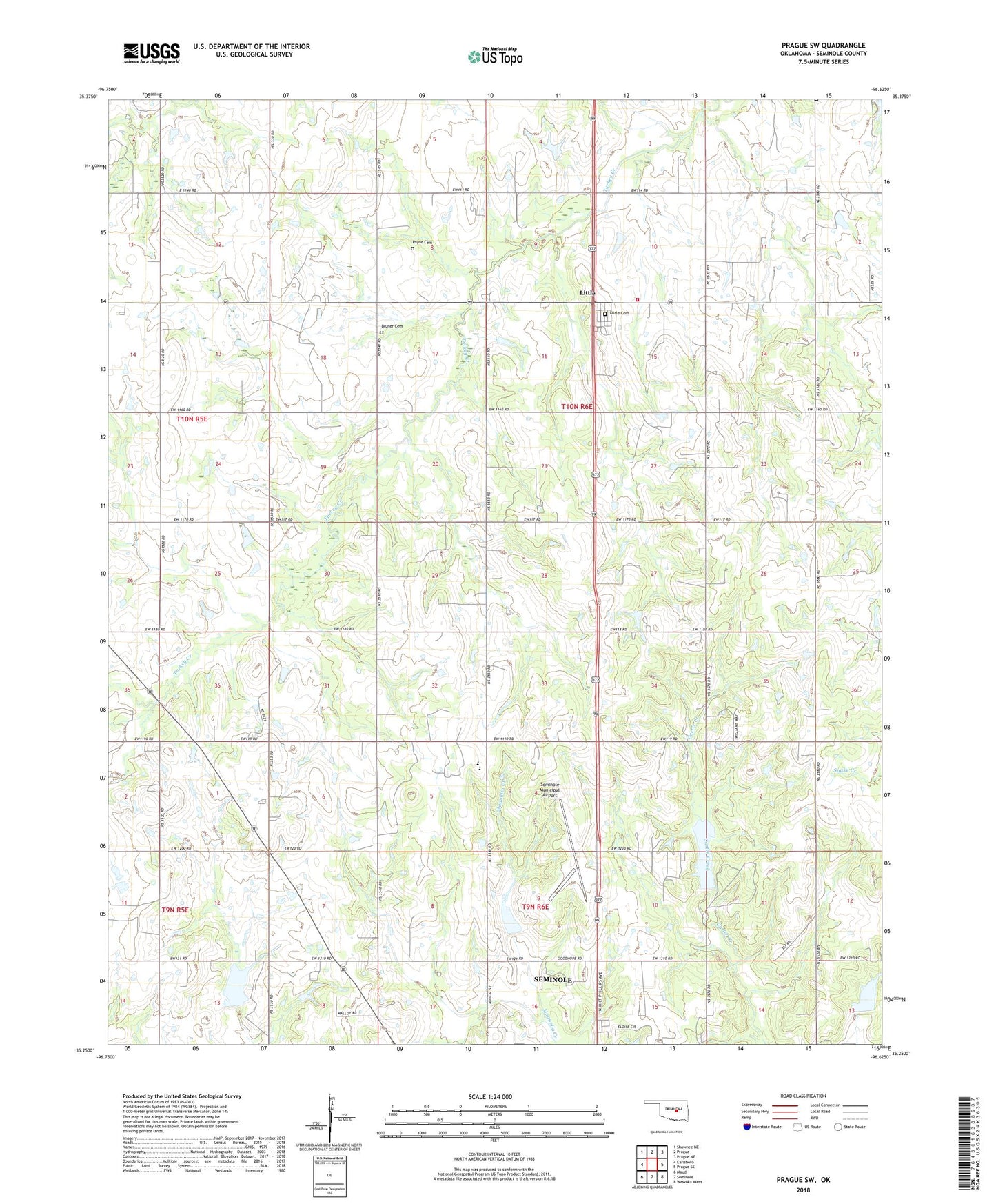
2018 topographic map quadrangle Prague SW in the state of Oklahoma. Scale: 1:24000. Based on the newly updated USGS 7.5' US Topo map series, this map is in the following counties: Seminole. The map contains contour data, water features, and other items you are used to seeing on USGS maps, but also has updated roads and other features. This is the next generation of topographic maps. Printed on high-quality waterproof paper with UV fade-resistant inks.
Quads adjacent to this one:
West: Earlsboro
Northwest: Shawnee NE
North: Prague
Northeast: Prague NE
East: Prague SE
Southeast: Wewoka West
South: Seminole
Southwest: Maud
Contains the following named places: Big Wewoka Creek Site 3 Dam, Big Wewoka Creek Site 3 Reservoir, Big Wewoka Creek Site 5 Dam, Big Wewoka Creek Site 5 Reservoir, Big Wewoka Creek Site 9 Dam, Big Wewoka Creek Site 9 Reservoir, C Jarvis Dam, C Jarvis Reservoir, Earlsboro Oil Field, East Keokuk Oil Field, Goodhope School, Jarvis Church, Keokuk Oil Field, Little, Little Cemetery, Little Church, Mediflight Oklahoma, Mount Zion Cemetery, North Searight Oil Field, Payne Cemetery, Prairie Valley School, Searight Oil Field, Seminole Municipal Airport, Seminole North Division, Strother Fire Department Fire Rescue, Township of Econtuchka, Twin Oak Church, Varnum Church, Varnum Elementary School, Varnum High School, ZIP Code: 74868