MyTopo
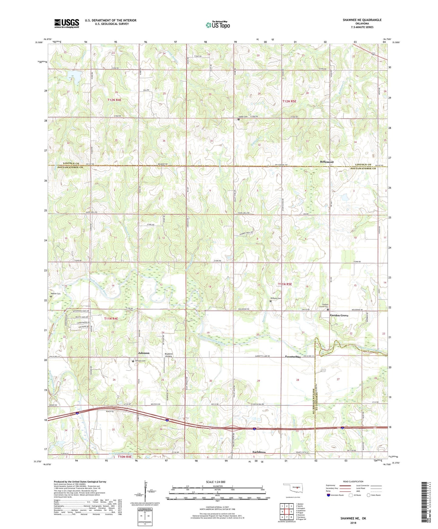
Shawnee NE Oklahoma US Topo Map
Couldn't load pickup availability
2023 topographic map quadrangle Shawnee NE in the state of Oklahoma. Scale: 1:24000. Based on the newly updated USGS 7.5' US Topo map series, this map is in the following counties: Pottawatomie, Lincoln, Seminole. The map contains contour data, water features, and other items you are used to seeing on USGS maps, but also has updated roads and other features. This is the next generation of topographic maps. Printed on high-quality waterproof paper with UV fade-resistant inks.
Quads adjacent to this one:
West: Aydelotte
Northwest: Meeker
North: Sparks
Northeast: Arlington
East: Prague
Southeast: Prague SW
South: Earlsboro
Southwest: Shawnee
This map covers the same area as the classic USGS quad with code o35096d7.
Contains the following named places: Bellemont, Bluebird Airpark, Econtuchka, Ellis Lake, Ellis Lake Dam, Gable Cemetery, Garden Grove, Garden Grove Cemetery, Johnson, Johnson Cemetery, McConnell Memorial Church, McKosta Cemetery, Nagowee Church, Northeast Shawnee Oil Field, Oknoname 12517 Dam, Oknoname 12517 Reservoir, Oknoname 12519 Dam, Oknoname 12519 Reservoir, Oknoname 12520 Dam, Oknoname 12520 Reservoir, Painter Creek, Quapaw Creek Site 10 Dam, Quapaw Creek Site 10 Reservoir, Quapaw Creek Site 11 Dam, Quapaw Creek Site 11 Reservoir, Quapaw Creek Site 8 Dam, Quapaw Creek Site 8 Reservoir, Quapaw Creek Site 9 Dam, Quapaw Creek Site 9 Reservoir, Rock Creek, Squaw Creek, Stamp Dance Creek, Town of Johnson, Wakolee Cemetery, West Bellemont Oil Field