MyTopo
Proctor Oklahoma US Topo Map
Couldn't load pickup availability
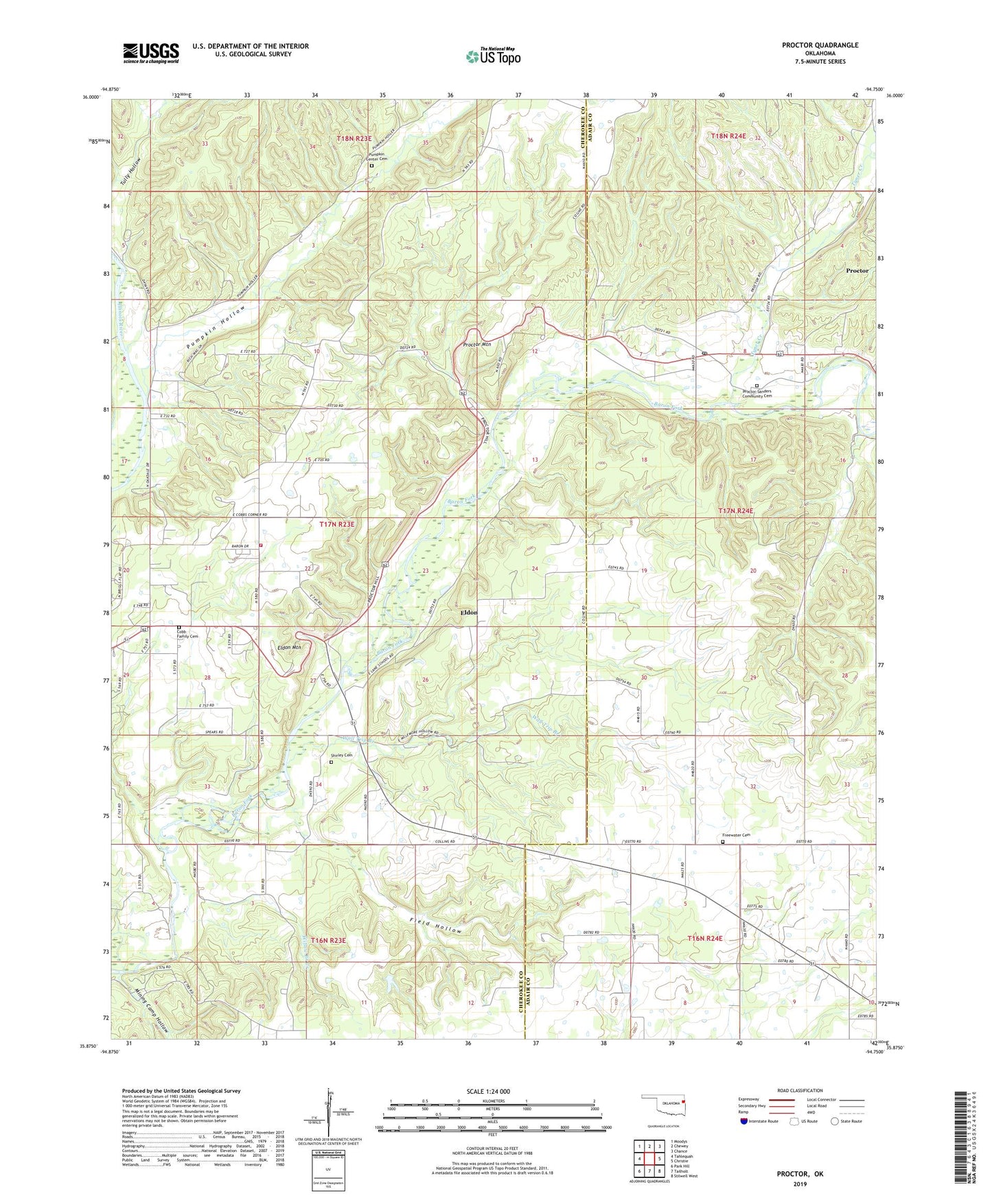
2019 topographic map quadrangle Proctor in the state of Oklahoma. Scale: 1:24000. Based on the newly updated USGS 7.5' US Topo map series, this map is in the following counties: Cherokee, Adair. The map contains contour data, water features, and other items you are used to seeing on USGS maps, but also has updated roads and other features. This is the next generation of topographic maps. Printed on high-quality waterproof paper with UV fade-resistant inks.
Quads adjacent to this one:
West: Tahlequah
Northwest: Moodys
North: Chewey
Northeast: Chance
East: Christie
Southeast: Stilwell West
South: Tailholt
Southwest: Park Hill
Contains the following named places: Briggs, Briggs Elementary School, Camp Egan, Cobb Family Cemetery, Eldon, Eldon Census Designated Place, Eldon Mountain, Field Hollow, Freewater Cemetery, Long Spring Church, Mining Camp Hollow, New Spring Place, Oakdale Church, Proctor, Proctor - Sanders Community Cemetery, Proctor Church, Proctor Mountain, Proctor Post Office, Pumpkin Center Cemetery, Pumpkin Hollow, Shirley Cemetery, Titanic, Township of Briggs, Tyner Creek, Wall Trip Branch, Welling Census Designated Place, Welling Tri - Community Fire Department Station 2, Willow Branch Creek