MyTopo
Chewey Oklahoma US Topo Map
Couldn't load pickup availability
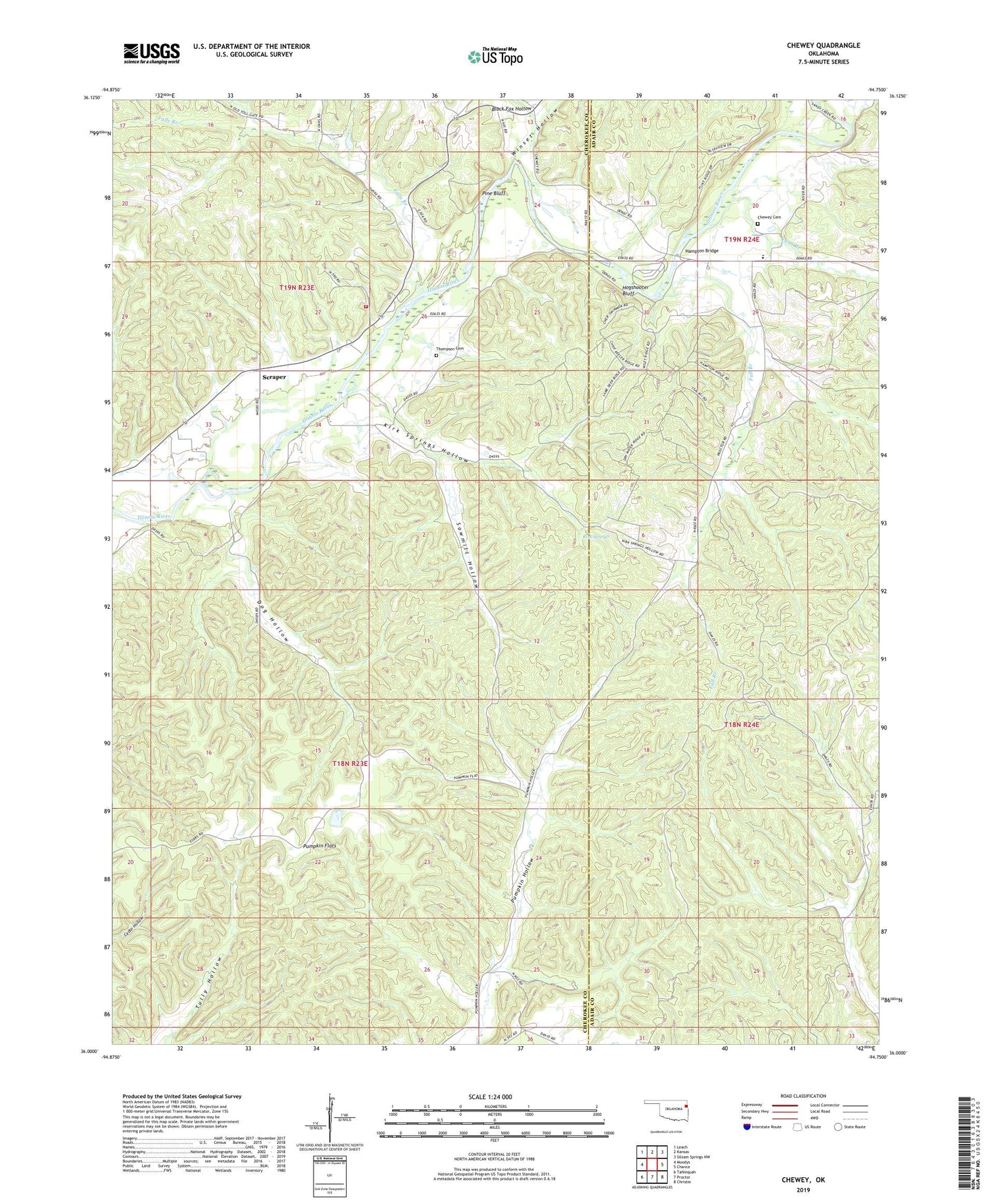
2022 topographic map quadrangle Chewey in the state of Oklahoma. Scale: 1:24000. Based on the newly updated USGS 7.5' US Topo map series, this map is in the following counties: Cherokee, Adair. The map contains contour data, water features, and other items you are used to seeing on USGS maps, but also has updated roads and other features. This is the next generation of topographic maps. Printed on high-quality waterproof paper with UV fade-resistant inks.
Quads adjacent to this one:
West: Moodys
Northwest: Leach
North: Kansas
Northeast: Siloam Springs NW
East: Chance
Southeast: Christie
South: Proctor
Southwest: Tahlequah
This map covers the same area as the classic USGS quad with code o36094a7.
Contains the following named places: Black Fox Hollow, Chewey, Chewey Cemetery, Dog Hollow, Fall Branch, Falls Branch, Hampton Bridge, Hogshooter Bluff, Illinois River Association Fire Station, Kirk Springs, Kirk Springs Hollow, Luna Branch, Pine Bluff, Proctor, Pumpkin Flats, Pumpkin Hollow Census Designated Place, Round Hollow Public Access Area, Sawmill Hollow, Scraper, Skelly Public School, Thompson Cemetery, Winset Hollow, ZIP Code: 74457