MyTopo
Chance Oklahoma US Topo Map
Couldn't load pickup availability
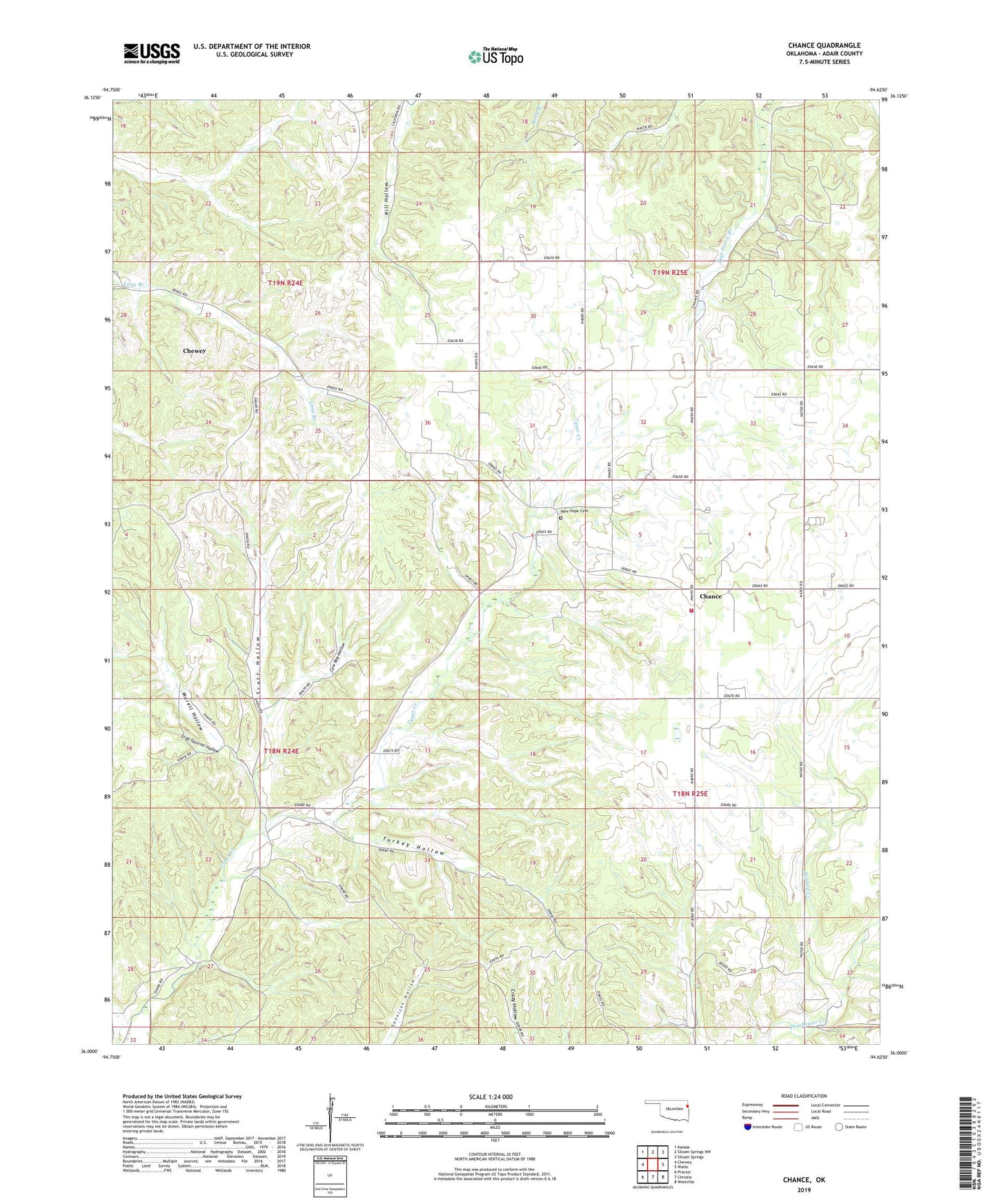
2022 topographic map quadrangle Chance in the state of Oklahoma. Scale: 1:24000. Based on the newly updated USGS 7.5' US Topo map series, this map is in the following counties: Adair. The map contains contour data, water features, and other items you are used to seeing on USGS maps, but also has updated roads and other features. This is the next generation of topographic maps. Printed on high-quality waterproof paper with UV fade-resistant inks.
Quads adjacent to this one:
West: Chewey
Northwest: Kansas
North: Siloam Springs NW
Northeast: Siloam Springs
East: Watts
Southeast: Westville
South: Christie
Southwest: Proctor
This map covers the same area as the classic USGS quad with code o36094a6.
Contains the following named places: Chance, Chance Census Designated Place, Chance Volunteer Fire Department, Chewey, Chewey Census Designated Place, Clear Fork Church, Cow Bog Hollow, Gray Squirrel Hollow, Jaybird Church, Jaybird Creek, Murell Hollow, New Hope Cemetery, New Hope Church, Scott Hollow, Township of Chance, Turkey Hollow, Watts Division, Westville Division, ZIP Code: 74964