MyTopo
Robert S Kerr Dam Oklahoma US Topo Map
Couldn't load pickup availability
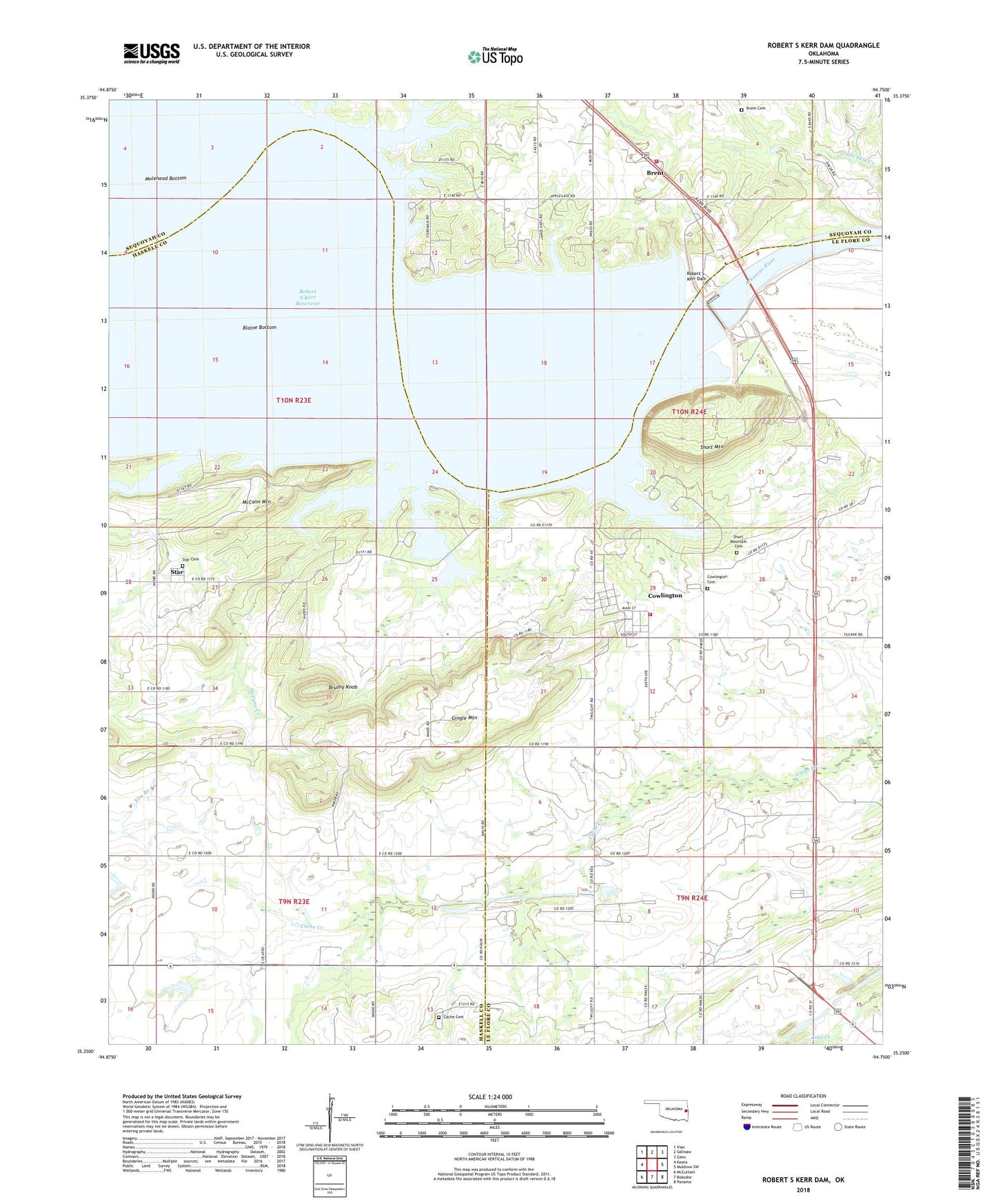
2018 topographic map quadrangle Robert S Kerr Dam in the state of Oklahoma. Scale: 1:24000. Based on the newly updated USGS 7.5' US Topo map series, this map is in the following counties: Haskell, Le Flore, Sequoyah. The map contains contour data, water features, and other items you are used to seeing on USGS maps, but also has updated roads and other features. This is the next generation of topographic maps. Printed on high-quality waterproof paper with UV fade-resistant inks.
Quads adjacent to this one:
West: Keota
Northwest: Vian
North: Sallisaw
Northeast: Gans
East: Muldrow SW
Southeast: Panama
South: Bokoshe
Southwest: McCurtain
Contains the following named places: Blaine Bottom, Brent, Brent Cemetery, Brent Census Designated Place, Brent Volunteer Fire Department, Brushy Knob, Cache Cemetery, Cowlington Cemetery, Cowlington Volunteer Fire Department, Gingle Mountain, McCann Creek, McCann Mountain, Negro Creek, Robert S Kerr Dam, Robert S Kerr Lock and Dam 15, Sallisaw Creek, Sans Bois, Short Mountain, Short Mountain Cemetery, Star, Star Cemetery, Town of Cowlington, Township of Brent, Township of Cowlington