MyTopo
Duke Oklahoma US Topo Map
Couldn't load pickup availability
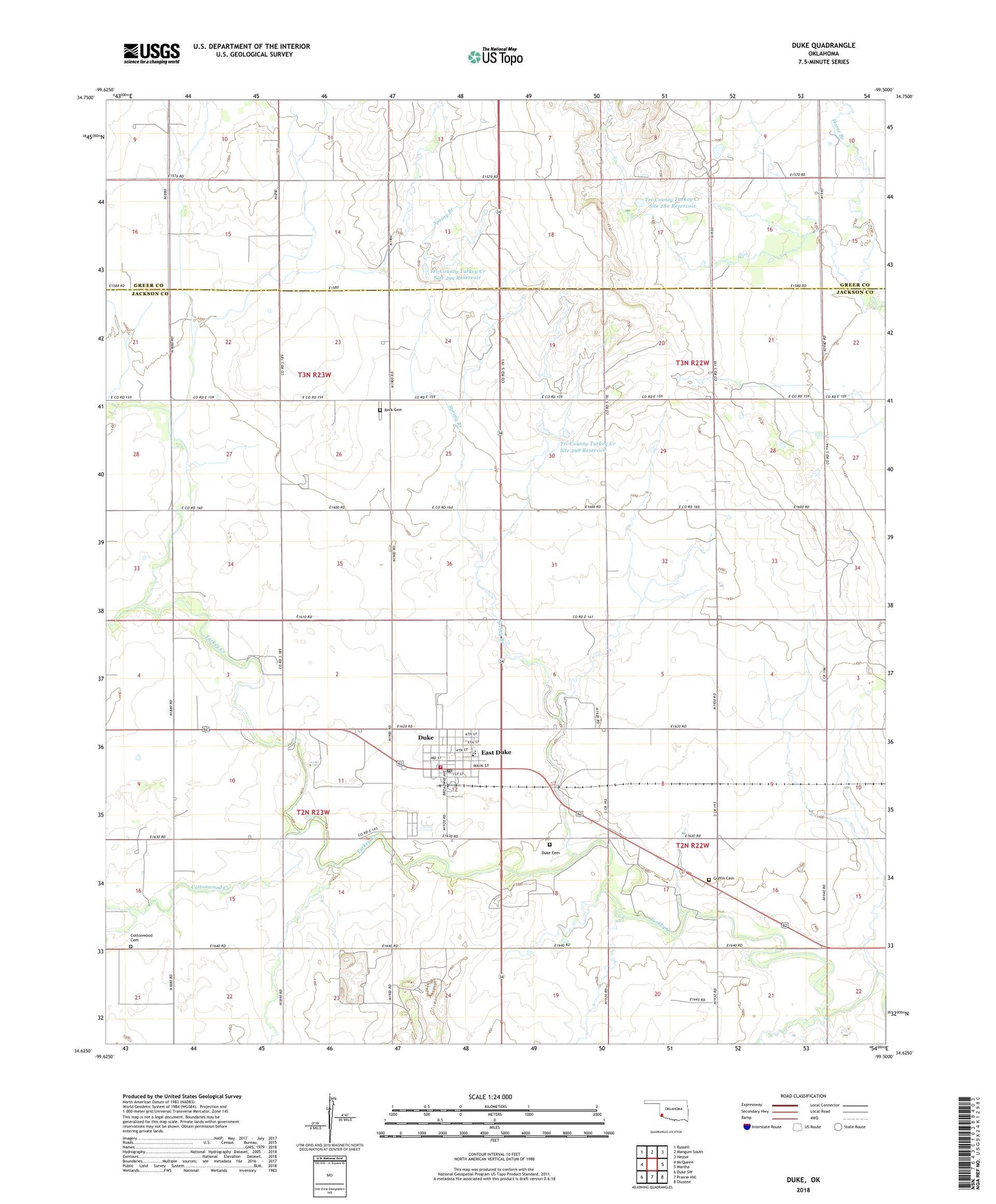
2022 topographic map quadrangle Duke in the state of Oklahoma. Scale: 1:24000. Based on the newly updated USGS 7.5' US Topo map series, this map is in the following counties: Jackson, Greer. The map contains contour data, water features, and other items you are used to seeing on USGS maps, but also has updated roads and other features. This is the next generation of topographic maps. Printed on high-quality waterproof paper with UV fade-resistant inks.
Quads adjacent to this one:
West: McQueen
Northwest: Russell
North: Mangum South
Northeast: Hester
East: Martha
Southeast: Olustee
South: Prairie Hill
Southwest: Duke SW
This map covers the same area as the classic USGS quad with code o34099f5.
Contains the following named places: Cottonwood Cemetery, Cottonwood Creek, Duke, Duke Cemetery, Duke High School, Duke Police Department, Duke Post Office, Duke Public School, Duke Volunteer Fire Department, Guffin Cemetery, Rock Cemetery, Spring Branch, Town of East Duke, Township of Duke, Tri-County Turkey Creek Site 28a Dam, Tri-County Turkey Creek Site 28a Reservoir, Tri-County Turkey Creek Site 298 Dam, Tri-County Turkey Creek Site 298 Reservoir, Tri-County Turkey Creek Site 29a Dam, Tri-County Turkey Creek Site 29a Reservoir, ZIP Code: 73532