MyTopo
McLoud Oklahoma US Topo Map
Couldn't load pickup availability
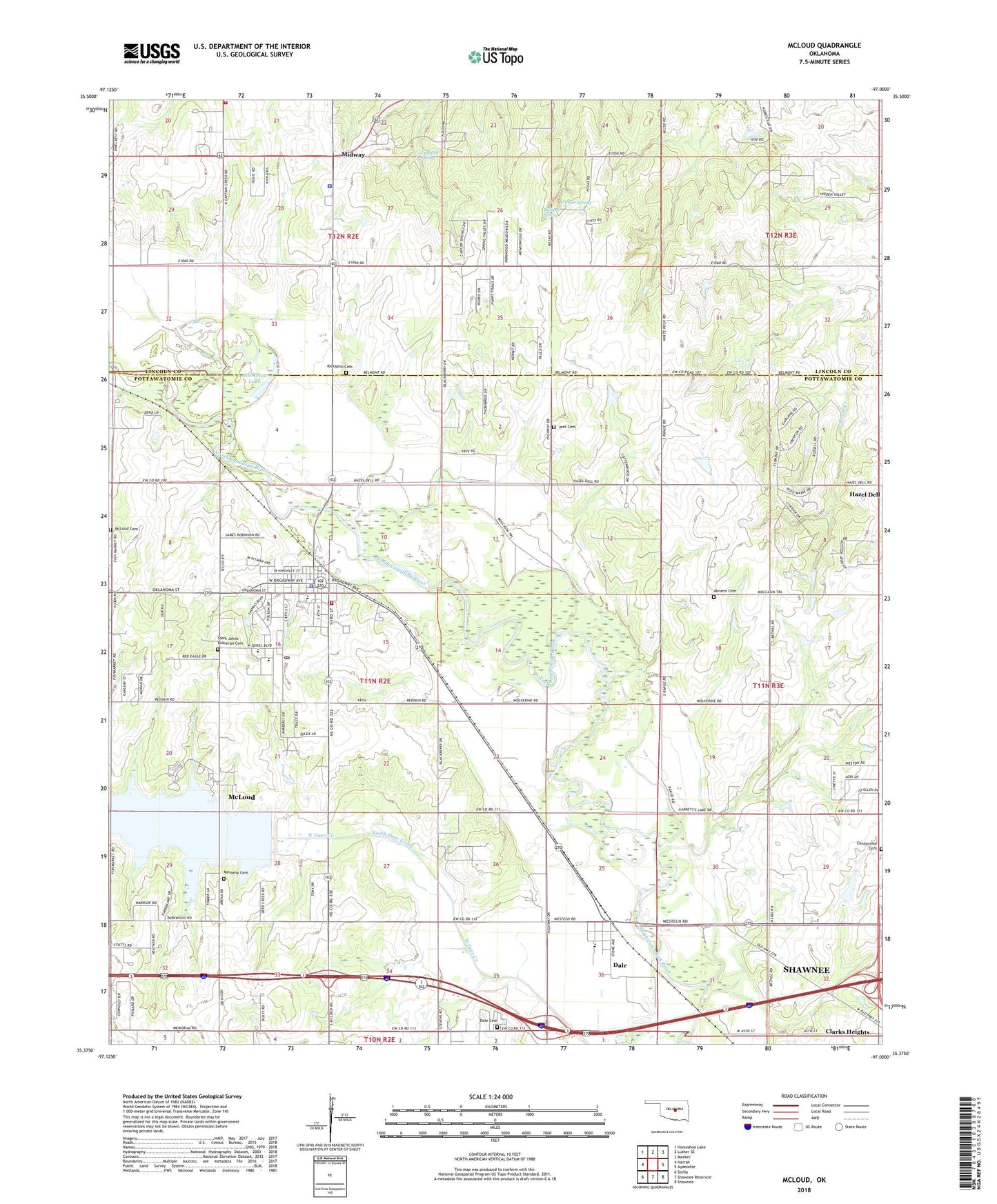
2022 topographic map quadrangle McLoud in the state of Oklahoma. Scale: 1:24000. Based on the newly updated USGS 7.5' US Topo map series, this map is in the following counties: Pottawatomie, Lincoln. The map contains contour data, water features, and other items you are used to seeing on USGS maps, but also has updated roads and other features. This is the next generation of topographic maps. Printed on high-quality waterproof paper with UV fade-resistant inks.
Quads adjacent to this one:
West: Harrah
Northwest: Horseshoe Lake
North: Luther SE
Northeast: Meeker
East: Aydelotte
Southeast: Shawnee
South: Shawnee Reservoir
Southwest: Stella
This map covers the same area as the classic USGS quad with code o35097d1.
Contains the following named places: Abrams Cemetery, Assembly of God Church, Bullard Spring, Centerville Cemetery, Chager Spring, Church of Christ, Church of Christ Lakeview, City of McLoud, Clarks Heights, Dale, Dale Cemetery, Dale Census Designated Place, Dale Elementary School, Dale High School, Dale Public School, Doddehl Spring, First United Methodist Church, Flying N Ranch Airport, Hazel Dell, Jent Cemetery, Kickapoo Friends Church Cemetery, Kickapoo Mission, Kickapoo Tribal Police, Kishketon Lake, L D Airport, McLoud, McLoud Elementary School, McLoud Fire Department, McLoud Gas Field, McLoud High School, McLoud Junior High School, McLoud Police Department, McLoud Post Office, McLoud Riverside Cemetery, Midway, Minneha Cemetery, Minneha Church, Saint Johns Lutheran Cemetery, Saint Vincent De Paul Church, Southwest Lincoln County Fire Protection District 1 Station 3, Township of Bales, Wagon Wheel School, ZIP Code: 74851