MyTopo
Shoals Oklahoma US Topo Map
Couldn't load pickup availability
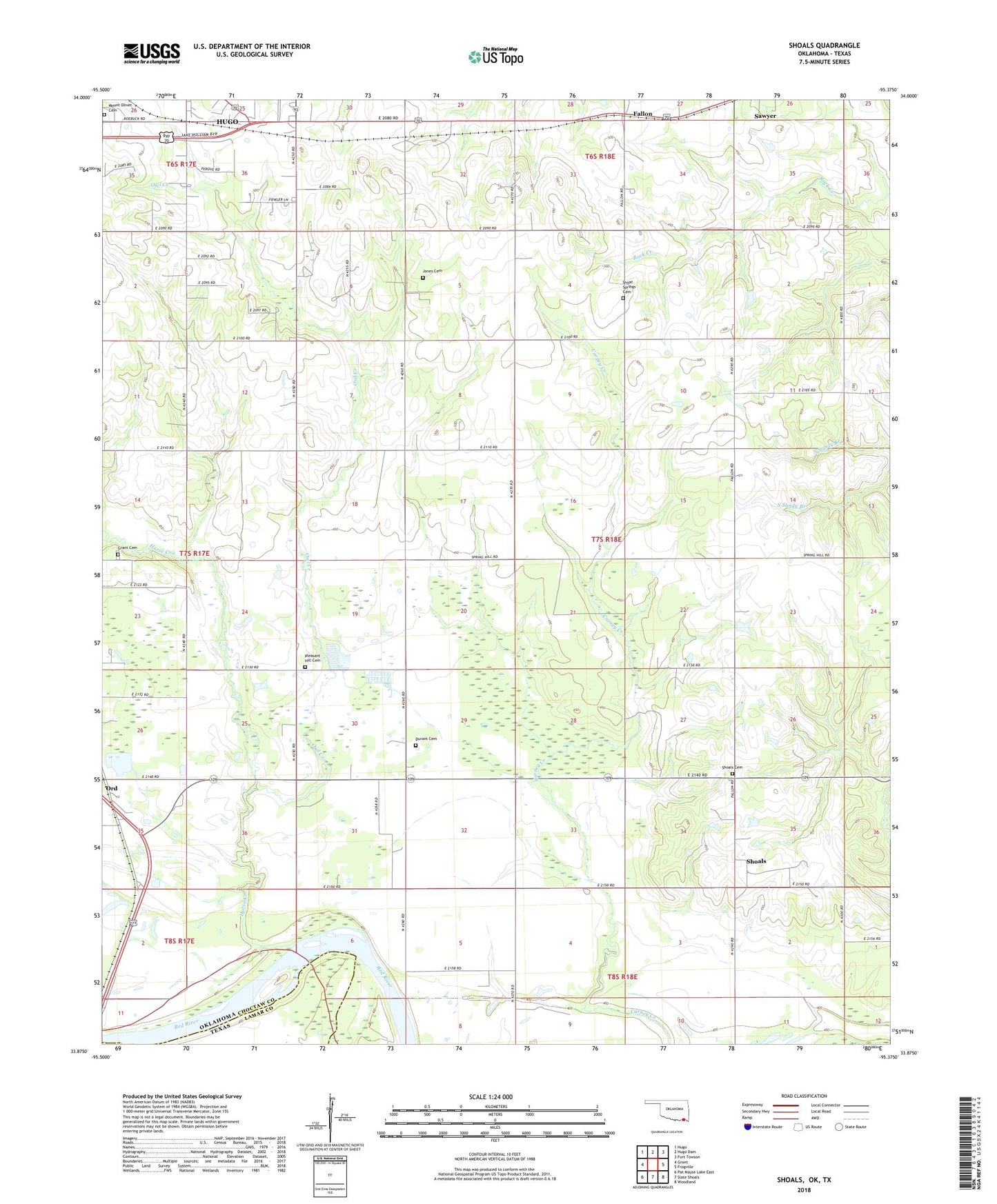
2018 topographic map quadrangle Shoals in the state of Oklahoma. Scale: 1:24000. Based on the newly updated USGS 7.5' US Topo map series, this map is in the following counties: Choctaw, Lamar. The map contains contour data, water features, and other items you are used to seeing on USGS maps, but also has updated roads and other features. This is the next generation of topographic maps. Printed on high-quality waterproof paper with UV fade-resistant inks.
Quads adjacent to this one:
West: Grant
Northwest: Hugo
North: Hugo Dam
Northeast: Fort Towson
East: Frogville
Southeast: Woodland
South: Slate Shoals
Southwest: Pat Mayse Lake East
Contains the following named places: Bearden Springs School, Bethel Church, Choctaw County Ambulance Authority, Durant Cemetery, Ervin School, Fallon, Grant Cemetery, Horse Creek, Horse Prairie School, Jones Cemetery, KITX-FM (Hugo), Lone Elm School, Mount Olivet Cemetery, Oknoname 023003 Dam, Oknoname 023003 Reservoir, Ord, Owl Creek, Pleasant Hill Cemetery, Shoals, Shoals Cemetery, Shoals Chapel School, Shoals Church, Shoals School, Shoat Lake School, Shoat Springs Cemetery, Shoat Springs School, Township of Everidge, ZIP Code: 74738