MyTopo
Fort Towson Oklahoma US Topo Map
Couldn't load pickup availability
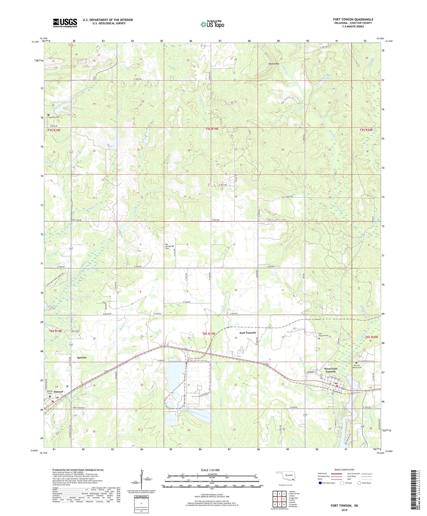
2022 topographic map quadrangle Fort Towson in the state of Oklahoma. Scale: 1:24000. Based on the newly updated USGS 7.5' US Topo map series, this map is in the following counties: Choctaw. The map contains contour data, water features, and other items you are used to seeing on USGS maps, but also has updated roads and other features. This is the next generation of topographic maps. Printed on high-quality waterproof paper with UV fade-resistant inks.
Quads adjacent to this one:
West: Hugo Dam
Northwest: Rattan
North: Spencerville
Northeast: Sobol
East: Swink
Southeast: Kiomatia
South: Frogville
Southwest: Shoals
This map covers the same area as the classic USGS quad with code o34095a3.
Contains the following named places: Box Springs Cemetery, Box Springs Church, Bull Creek, Fort Towson, Fort Towson Cemetery, Fort Towson Creek, Fort Towson Division, Fort Towson Elementary School, Fort Towson Fire Department, Fort Towson High School, Fort Towson Post Office, Lake Raymond Gary, Oil Well Branch, Oknoname 023004 Dam, Oknoname 023004 Reservoir, Oknoname 023005 Dam, Oknoname 023005 Reservoir, Oknoname 023006 Dam, Oknoname 023006 Reservoir, Old Fort Towson Cemetery, Old Fort Towson Historic Site, Round Mountain, Sawyer, Sawyer Cemetery, Sawyer Fire Department, Sawyer Police Department, Sawyer Post Office, Schooler Cemetery, Schooler Lake, Schooler Lake Dam, Town of Fort Towson, Township of Wilson, West Fort Towson, ZIP Code: 74756