MyTopo
Stanley Oklahoma US Topo Map
Couldn't load pickup availability
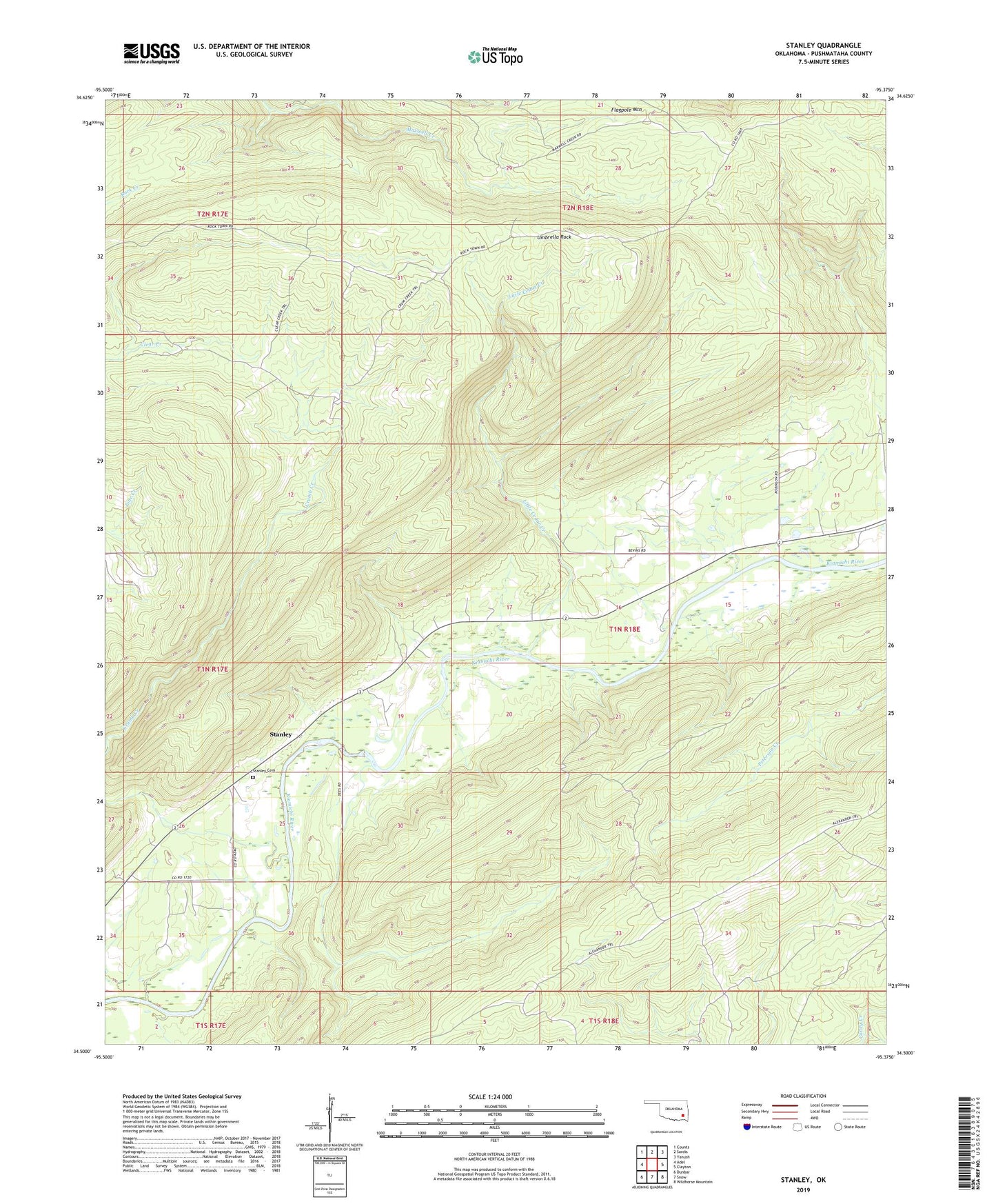
2022 topographic map quadrangle Stanley in the state of Oklahoma. Scale: 1:24000. Based on the newly updated USGS 7.5' US Topo map series, this map is in the following counties: Pushmataha. The map contains contour data, water features, and other items you are used to seeing on USGS maps, but also has updated roads and other features. This is the next generation of topographic maps. Printed on high-quality waterproof paper with UV fade-resistant inks.
Quads adjacent to this one:
West: Adel
Northwest: Counts
North: Sardis
Northeast: Yanush
East: Clayton
Southeast: Wildhorse Mountain
South: Snow
Southwest: Dunbar
This map covers the same area as the classic USGS quad with code o34095e4.
Contains the following named places: Choctaw Oklahoma Tribal Statistical Area, Clear Creek Trail, Crumb Creek, Crumb Creek Trail, Flagpole Lookout Tower, High Rock Trail, Little Cedar Creek, Pushmataha County State Game Refuge, Stanley, Stanley Cemetery, Umbrella Rock, ZIP Code: 74536