MyTopo
Stidham Oklahoma US Topo Map
Couldn't load pickup availability
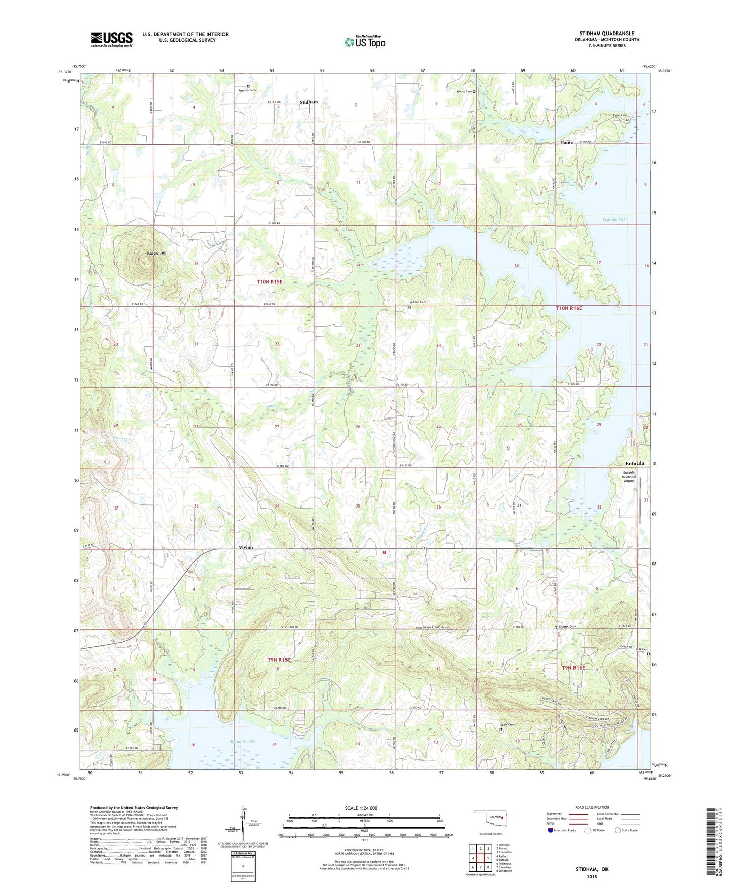
2018 topographic map quadrangle Stidham in the state of Oklahoma. Scale: 1:24000. Based on the newly updated USGS 7.5' US Topo map series, this map is in the following counties: McIntosh. The map contains contour data, water features, and other items you are used to seeing on USGS maps, but also has updated roads and other features. This is the next generation of topographic maps. Printed on high-quality waterproof paper with UV fade-resistant inks.
Quads adjacent to this one:
West: Raiford
Northwest: Hoffman
North: Pierce
Northeast: Checotah
East: Eufaula
Southeast: Longtown
South: Canadian
Southwest: Indianola
Contains the following named places: Artussee Indian Church, Badger Hill, Carters Corner, Charles Cemetery, Eufaula Division, Evans Cemetery, Fame, Fame Cemetery, Hutton Cemetery, McIntosh County, Moore Cemetery, Muskogee Church, Polk Cemetery, Remsey Cemetery, Scott Cemetery, Stidham, Town of Stidham, Township of Simpson, Vivian, Vivian Area Fire Protection Association Headquarters, Vivian Area Fire Protection Association Oak Grove, Vivian Church, Washington Cemetery, ZIP Code: 74432