MyTopo
Tonkawa Oklahoma US Topo Map
Couldn't load pickup availability
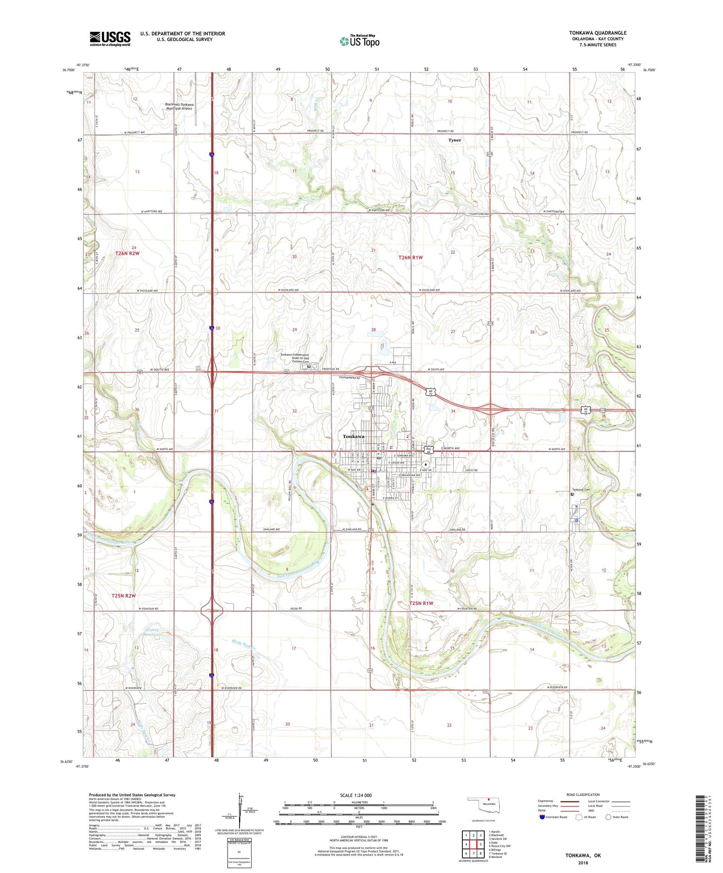
2018 topographic map quadrangle Tonkawa in the state of Oklahoma. Scale: 1:24000. Based on the newly updated USGS 7.5' US Topo map series, this map is in the following counties: Kay. The map contains contour data, water features, and other items you are used to seeing on USGS maps, but also has updated roads and other features. This is the next generation of topographic maps. Printed on high-quality waterproof paper with UV fade-resistant inks.
Quads adjacent to this one:
West: Eddy
Northwest: Nardin
North: Blackwell
Northeast: Newkirk SW
East: Ponca City NW
Southeast: Marland
South: Tonkawa SE
Southwest: Billings
Contains the following named places: Blackwell-Tonkawa Municipal Airport, Blen Park, Catholic Church, City of Tonkawa, Deer Creek, First Baptist Church, First Christian Church, Fort Oakland Police Department, KAYE-FM (Tonkawa), Lincoln School, Northern Oklahoma College, Oknoname 071006 Dam, Oknoname 071006 Reservoir, Oknoname 071013 Dam, Oknoname 071013 Reservoir, Ray See Park, Stink Creek, Tonkawa, Tonkawa Bible Church, Tonkawa Cemetery, Tonkawa Division, Tonkawa Elementary School, Tonkawa Fire Department and Ambulance Service, Tonkawa High School, Tonkawa Independent Order of Odd Fellows Cemetery, Tonkawa Middle School, Tonkawa Oklahoma Tribal Statistical Area, Tonkawa Police Department, Tonkawa Post Office, Tonkawa Tribal Housing Census Designated Place, Township of Owen, Township of Tonkawa, Tyner, United Methodist Church, Washington School, ZIP Code: 74653