MyTopo
Walters Oklahoma US Topo Map
Couldn't load pickup availability
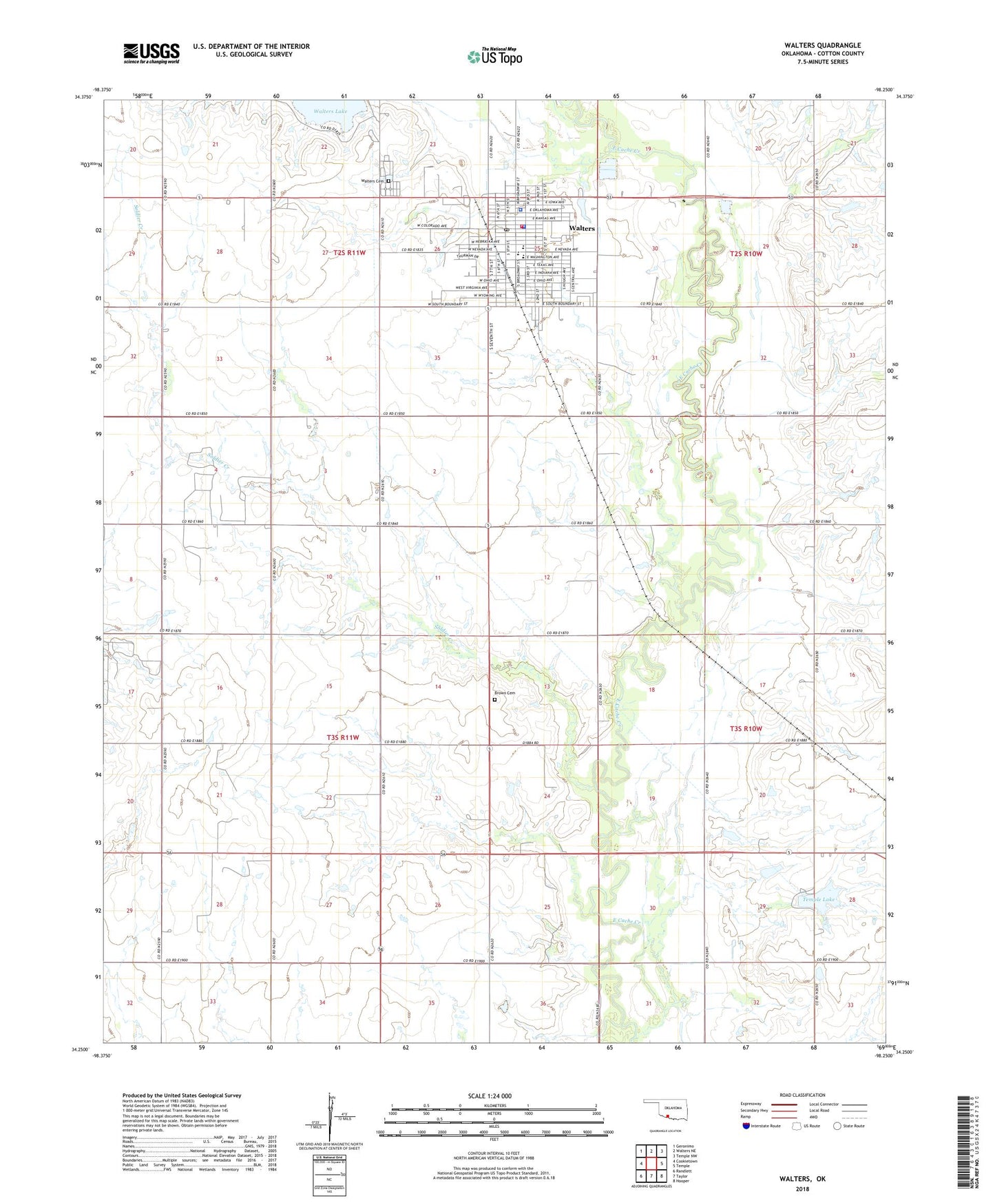
2022 topographic map quadrangle Walters in the state of Oklahoma. Scale: 1:24000. Based on the newly updated USGS 7.5' US Topo map series, this map is in the following counties: Cotton. The map contains contour data, water features, and other items you are used to seeing on USGS maps, but also has updated roads and other features. This is the next generation of topographic maps. Printed on high-quality waterproof paper with UV fade-resistant inks.
Quads adjacent to this one:
West: Cookietown
Northwest: Geronimo
North: Walters NE
Northeast: Temple NW
East: Temple
Southeast: Hooper
South: Taylor
Southwest: Randlett
This map covers the same area as the classic USGS quad with code o34098c3.
Contains the following named places: Brown Cemetery, Brown Church, City of Walters, Cotton County, Cotton County Jail, Cotton County Sheriff's Office, First Baptist Church, First Christian Church, Independent Church, Oknoname 033001 Dam, Oknoname 033001 Reservoir, Open Door Church of God, Saint Patrick Catholic Church, Soldier Creek, Tempe Lake Dam, Temple Lake, Township of Cache, Walters, Walters Cemetery, Walters Church of Christ, Walters Elementary School, Walters First United Methodist Church, Walters High School, Walters Lake, Walters Middle School, Walters Police Station, Walters Post Office, Walters Volunteer Ambulance Service, Walters Volunteer Fire Department, ZIP Code: 73572