MyTopo
Wayne Oklahoma US Topo Map
Couldn't load pickup availability
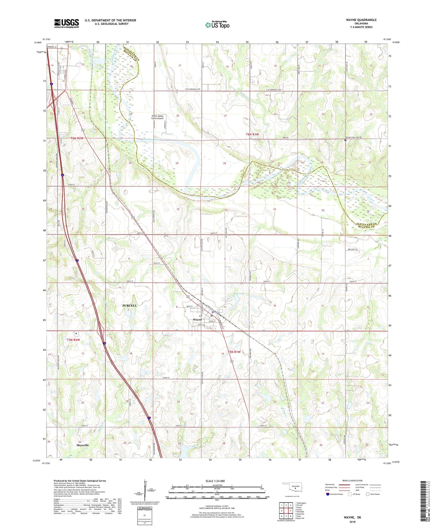
2022 topographic map quadrangle Wayne in the state of Oklahoma. Scale: 1:24000. Based on the newly updated USGS 7.5' US Topo map series, this map is in the following counties: McClain, Cleveland. The map contains contour data, water features, and other items you are used to seeing on USGS maps, but also has updated roads and other features. This is the next generation of topographic maps. Printed on high-quality waterproof paper with UV fade-resistant inks.
Quads adjacent to this one:
West: Stealy
Northwest: Washington
North: Purcell
Northeast: Eason
East: Rosedale
Southeast: Byars SW
South: Paoli
Southwest: Maysville
This map covers the same area as the classic USGS quad with code o34097h3.
Contains the following named places: C L Rose Lake Dam, Christian Crusaders Academy, Church of Christ, Denten Cemetery, Finn Creek Site 35 Dam, Finn Creek Site 35 Reservoir, Finn Creek Site 36 Dam, Finn Creek Site 36 Reservoir, Green Valley Farms Airport, Lexington Division, Mid - America Technology Center, Oknoname 087044 Dam, Oknoname 087044 Reservoir, Owl Creek Site 1 Dam, Owl Creek Site 1 Reservoir, Owl Creek Site 10 Dam, Owl Creek Site 10 Reservoir, Owl Creek Site 2 Dam, Owl Creek Site 2 Reservoir, Owl Creek Site 3 Dam, Owl Creek Site 3 Reservoir, Owl Creek Site 4 Dam, Owl Creek Site 4 Reservoir, Owl Creek Site 8 Dam, Owl Creek Site 8 Reservoir, Owl Creek Site 9 Dam, Owl Creek Site 9 Reservoir, Rose Lake, Town of Wayne, Township of Wayne, Walnut Creek, Wayne, Wayne Elementary School, Wayne High School, Wayne Middle School, Wayne Police Department, Wayne Post Office, Wayne Volunteer Fire Department, West Corbett Oil Field, Willow Creek, ZIP Code: 73095