MyTopo
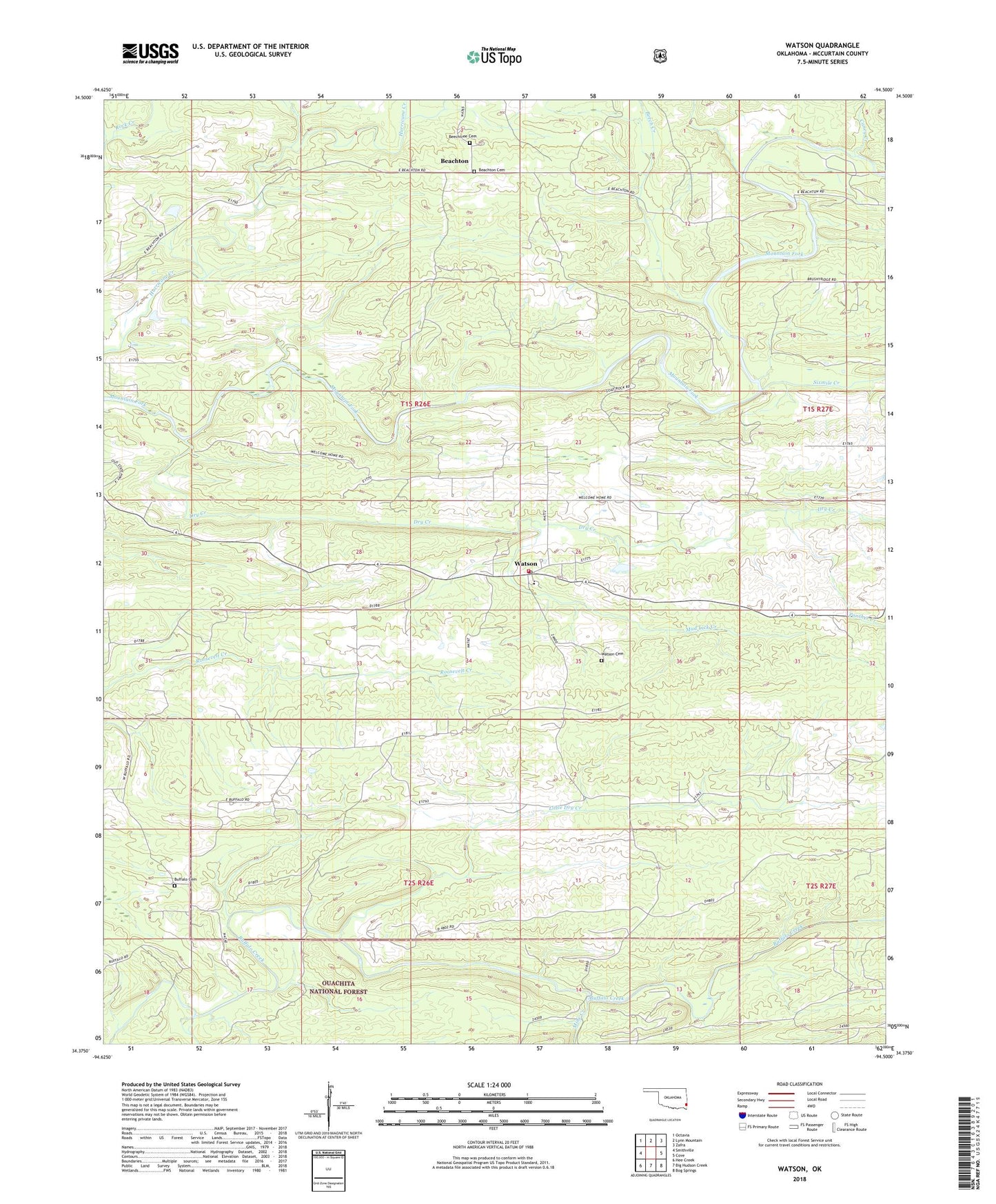
Watson Oklahoma US Topo Map
Couldn't load pickup availability
Also explore the Watson Forest Service Topo of this same quad for updated USFS data
2022 topographic map quadrangle Watson in the state of Oklahoma. Scale: 1:24000. Based on the newly updated USGS 7.5' US Topo map series, this map is in the following counties: McCurtain. The map contains contour data, water features, and other items you are used to seeing on USGS maps, but also has updated roads and other features. This is the next generation of topographic maps. Printed on high-quality waterproof paper with UV fade-resistant inks.
Quads adjacent to this one:
West: Smithville
Northwest: Octavia
North: Lynn Mountain
Northeast: Zafra
East: Cove
Southeast: Bog Springs
South: Big Hudson Creek
Southwest: Hee Creek
This map covers the same area as the classic USGS quad with code o34094d5.
Contains the following named places: Beachton, Beachton Cemetery, Beech Creek, Beechtree Cemetery, Big Hudson Creek, Buffalo Cemetery, Caney Creek, Dry Creek, Little Dry Creek, Mine Creek, Mud Lick Creek, Oknoname 089008 Dam, Oknoname 089008 Reservoir, Panther Creek, Sixmile Creek, Watson, Watson Cemetery, Watson Community Fire Department, Watson Elementary School, Watson Post Office, ZIP Code: 74963