MyTopo
Bog Springs Arkansas US Topo Map
Couldn't load pickup availability
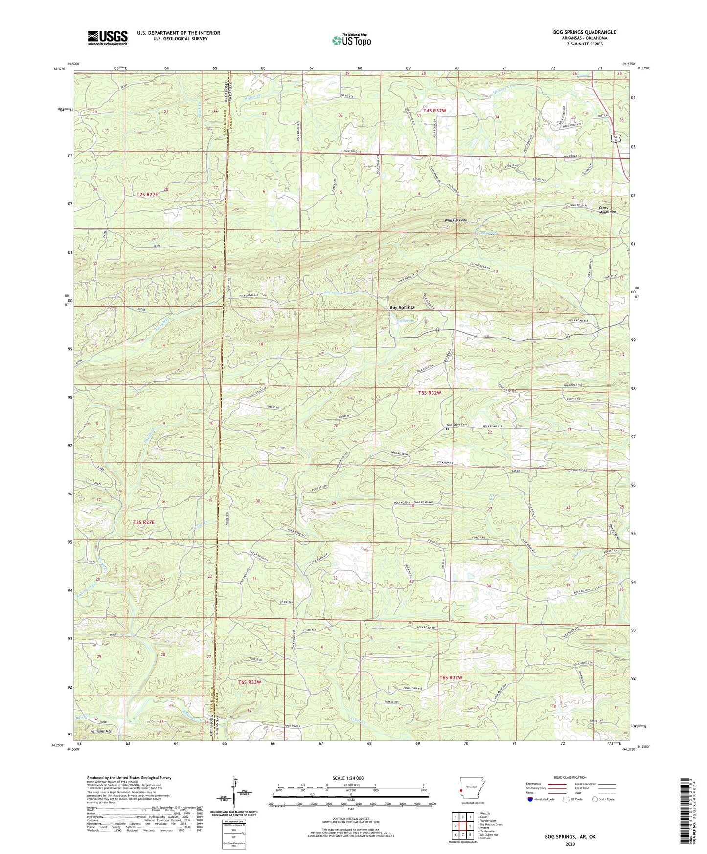
2024 topographic map quadrangle Bog Springs in the states of Arkansas, Oklahoma. Scale: 1:24000. Based on the newly updated USGS 7.5' US Topo map series, this map is in the following counties: Polk, McCurtain. The map contains contour data, water features, and other items you are used to seeing on USGS maps, but also has updated roads and other features. This is the next generation of topographic maps. Printed on high-quality waterproof paper with UV fade-resistant inks.
Quads adjacent to this one:
West: Big Hudson Creek
Northwest: Watson
North: Cove
Northeast: Vandervoort
East: Wickes
Southeast: Gillham
South: De Queen NW
Southwest: Tablerville
Contains the following named places: Bog Springs, Bogg Springs School, Bull Creek, Cedar Branch, Cross Mountains, Hatton Post Office, Kings Branch, Oak Grove Cemetery, Oak Grove Church, Odell Ford, Roff, Rough Creek, Rowell School, Shelton School, Sunflower School, Twin Springs, West Creek, Whiskey Peak