MyTopo
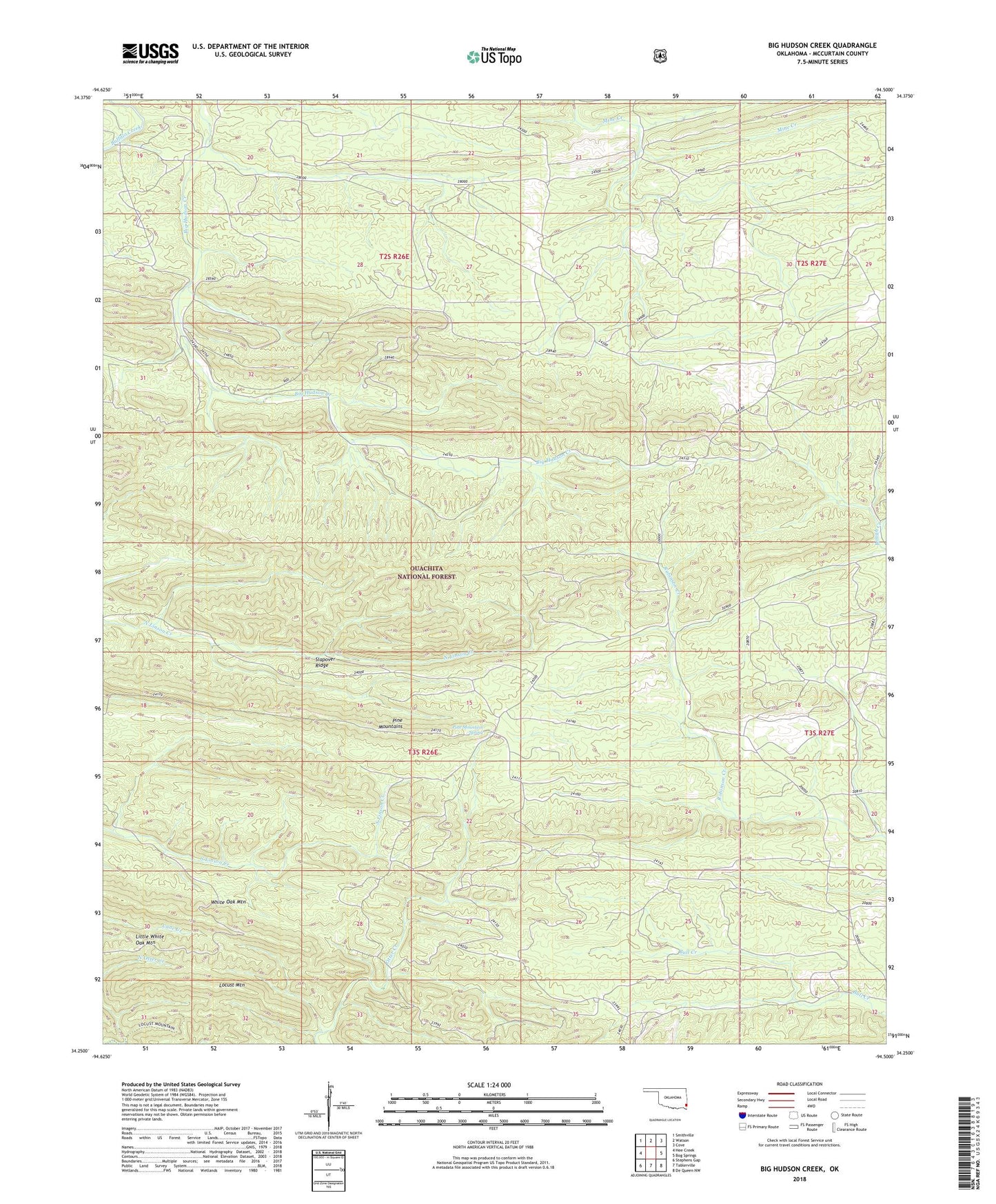
Big Hudson Creek Oklahoma US Topo Map
Couldn't load pickup availability
Also explore the Big Hudson Creek Forest Service Topo of this same quad for updated USFS data
2022 topographic map quadrangle Big Hudson Creek in the state of Oklahoma. Scale: 1:24000. Based on the newly updated USGS 7.5' US Topo map series, this map is in the following counties: McCurtain. The map contains contour data, water features, and other items you are used to seeing on USGS maps, but also has updated roads and other features. This is the next generation of topographic maps. Printed on high-quality waterproof paper with UV fade-resistant inks.
Quads adjacent to this one:
West: Hee Creek
Northwest: Smithville
North: Watson
Northeast: Cove
East: Bog Springs
Southeast: De Queen NW
South: Tablerville
Southwest: Stephens Gap
This map covers the same area as the classic USGS quad with code o34094c5.
Contains the following named places: Little White Oak Mountain, Pine Mountain Spring, Pine Mountains, Slapover Ridge, White Oak Mountain