MyTopo
Watts Oklahoma US Topo Map
Couldn't load pickup availability
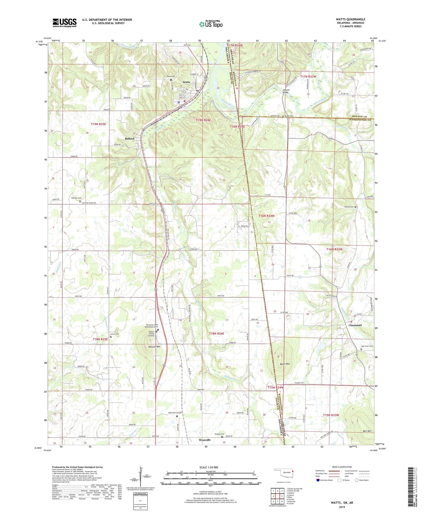
2022 topographic map quadrangle Watts in the states of Oklahoma, Arkansas. Scale: 1:24000. Based on the newly updated USGS 7.5' US Topo map series, this map is in the following counties: Adair, Washington, Benton. The map contains contour data, water features, and other items you are used to seeing on USGS maps, but also has updated roads and other features. This is the next generation of topographic maps. Printed on high-quality waterproof paper with UV fade-resistant inks.
Quads adjacent to this one:
West: Chance
Northwest: Siloam Springs NW
North: Siloam Springs
Northeast: Gallatin
East: Rhea
Southeast: Lincoln
South: Westville
Southwest: Christie
This map covers the same area as the classic USGS quad with code o36094a5.
Contains the following named places: Ballard, Ballard Church, Ballard Creek, Baptist Mission Cemetery, Bates Mountain, Bell Mountain, Brady Cemetery, Cincinnati, Cincinnati Census Designated Place, Cincinnati Creek, Cincinnati United Methodist Church, Cincinnati Volunteer Fire Station 2, Colony Community Church, Fairview School, Faith Chapel, Fishers Ford, Full Gospel Church, Goforth Bridge, Goforth Ford, Harold Cemetery, Lacie Cemetery, Mission Church, Mission Mountain, Nicodemus Community Church, Nicodemus School, Old Union Cemetery, Phillips Cemetery, Reverend Jesse Bushyhead Grave, Sixkiller Cemetery, Spring Harbor Landing, Town of Watts, Township of Ballard, Watts, Watts Cemetery, Watts Community, Watts Community Census Designated Place, Watts Elementary School, Watts Fire Department, Watts High School, Watts Police Department, Watts Post Office, Weddington Creek, Westville Cemetery