MyTopo
Siloam Springs NW Oklahoma US Topo Map
Couldn't load pickup availability
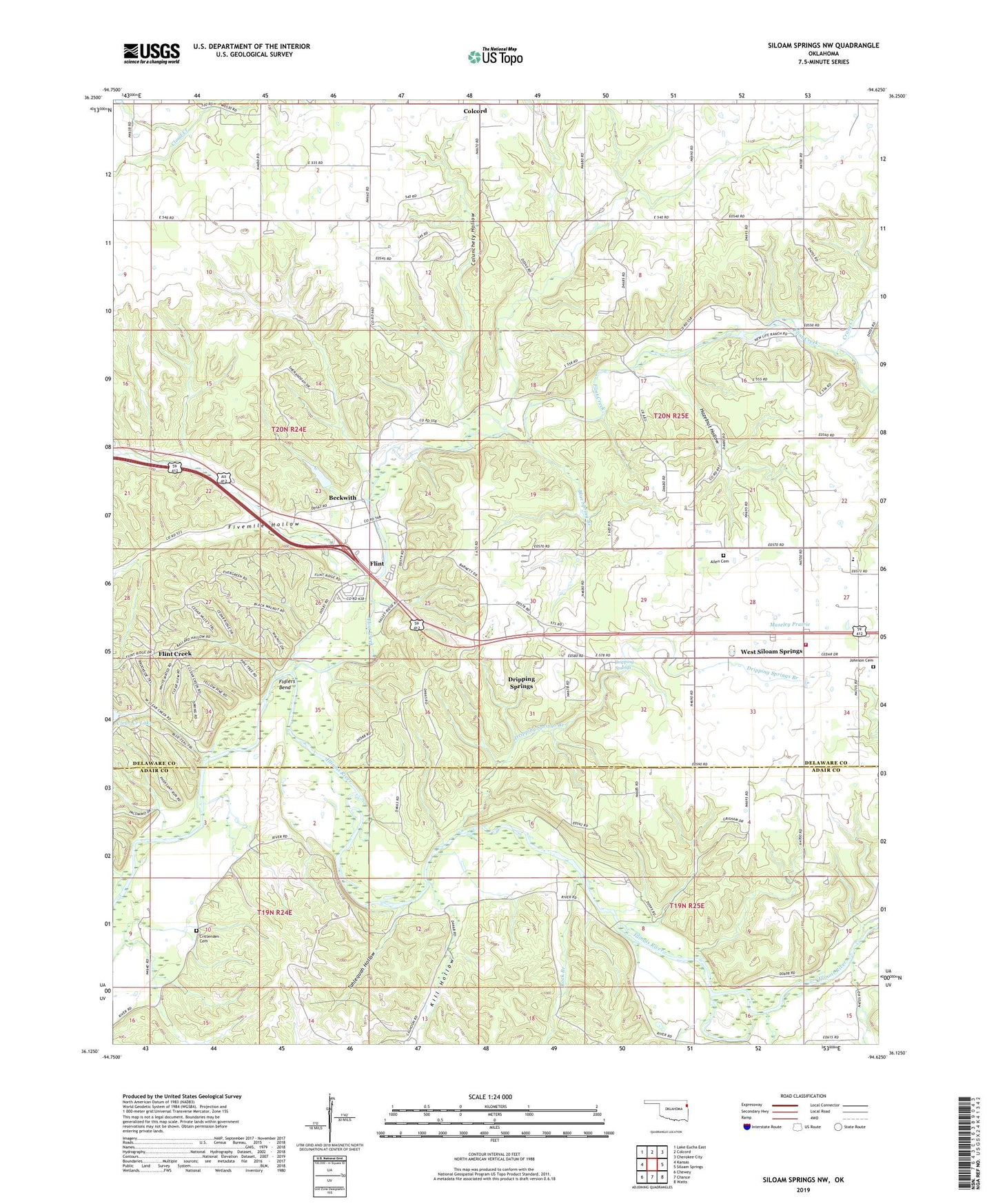
2022 topographic map quadrangle Siloam Springs NW in the state of Oklahoma. Scale: 1:24000. Based on the newly updated USGS 7.5' US Topo map series, this map is in the following counties: Delaware, Adair. The map contains contour data, water features, and other items you are used to seeing on USGS maps, but also has updated roads and other features. This is the next generation of topographic maps. Printed on high-quality waterproof paper with UV fade-resistant inks.
Quads adjacent to this one:
West: Kansas
Northwest: Lake Eucha East
North: Colcord
Northeast: Cherokee City
East: Siloam Springs
Southeast: Watts
South: Chance
Southwest: Chewey
This map covers the same area as the classic USGS quad with code o36094b6.
Contains the following named places: Allen Cemetery, Beckwith, Blue Spring Branch, Calunchety Hollow, Calvary Baptist Church, Clear Creek Lake, Colcord Division, Crazy Creek, Crittenden Cemetery, Dripping Springs, Dripping Springs Branch, Dripping Springs Census Designated Place, Fidlers Bend, Fivemile Hollow, Flint, Flint Creek, Flint Creek Census Designated Place, Hazelnut Hollow, Illinois River Church, Johnson Cemetery, Kill Hollow, Moseley Elementary School, Moseley Prairie, Rock Branch, Tahlequah Hollow, Tate Parris Branch, Township 2, Union Church, West Siloam Springs Volunteer Fire Department