MyTopo
Petrolia Texas US Topo Map
Couldn't load pickup availability
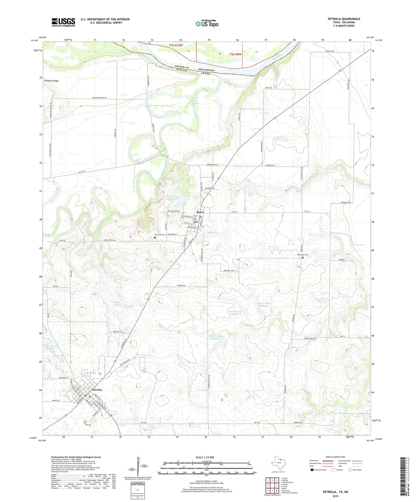
2022 topographic map quadrangle Petrolia in the state of Texas. Scale: 1:24000. Based on the newly updated USGS 7.5' US Topo map series, this map is in the following counties: Clay, Cotton. The map contains contour data, water features, and other items you are used to seeing on USGS maps, but also has updated roads and other features. This is the next generation of topographic maps. Printed on high-quality waterproof paper with UV fade-resistant inks.
Quads adjacent to this one:
West: Charlie
Northwest: Taylor
North: Hooper
Northeast: Waurika West
East: Irving
Southeast: Riverland Cemetery
South: Hurnville
Southwest: Dean
This map covers the same area as the classic USGS quad with code o34098a2.
Contains the following named places: Benvenue Cemetery, Byers, Byers City Hall, Byers City Reservoir, Byers City Reservoir Dam, Byers Post Office, Byers Volunteer Fire Department, Byers-Petrolia Division, City of Byers, City of Petrolia, Hay Creek, Mayo Lake, Mayo Lake Dam, Parker Lake Number 1, Parker Lake Number 1 Dam, Parker Lake Number 2, Parker Lake Number 2 Dam, Parker Lake Number 3, Parker Lake Number 3 Dam, Petrolia, Petrolia Elementary School, Petrolia High School, Petrolia Post Office, Petrolia Volunteer Fire Department, Riverside Cemetery, Wichita River, ZIP Code: 76357