MyTopo
Priday Reservoir Oregon US Topo Map
Couldn't load pickup availability
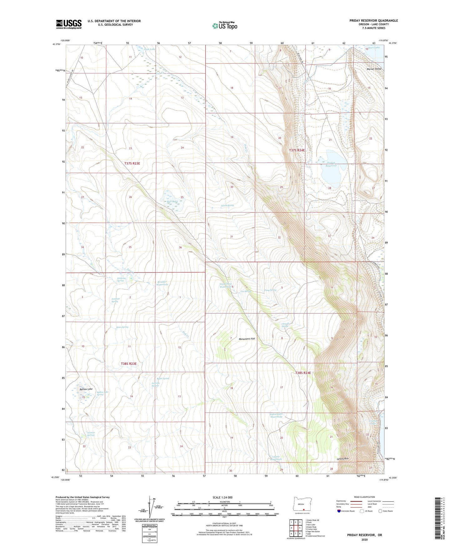
2024 topographic map quadrangle Priday Reservoir in the state of Oregon. Scale: 1:24000. Based on the newly updated USGS 7.5' US Topo map series, this map is in the following counties: Lake. The map contains contour data, water features, and other items you are used to seeing on USGS maps, but also has updated roads and other features. This is the next generation of topographic maps. Printed on high-quality waterproof paper with UV fade-resistant inks.
Quads adjacent to this one:
West: Drake Peak
Northwest: Drake Peak NE
North: Plush
Northeast: Hart Lake
East: Crump Lake
Southeast: Calderwood Reservoir
South: Adel
Southwest: Sage Hen Butte
This map covers the same area as the classic USGS quad with code o42119c8.
Contains the following named places: Antelope Spring, Anthony Springs, Ballew Lake, Ballew Lake Spring, Ballew Reservoir, Barry Ranch, Boulder Waterhole, Bull Lake, Bullet Spring, Cleland Spring, Cox Spring, Crump Lake Landing, Elmers Waterhole, Fang Spring, Finucane Spring, Fish Creek, Fish Lake, Good Seep Waterhole, Horn Spring, Lassie Waterhole, Lynch Spring, Monument Flat, Noonan Springs, Priday Reservoir, Sidewinder Waterhole, Wickiup Reservoir