MyTopo
Aldrich Gulch Oregon US Topo Map
Couldn't load pickup availability
Also explore the Aldrich Gulch Forest Service Topo of this same quad for updated USFS data
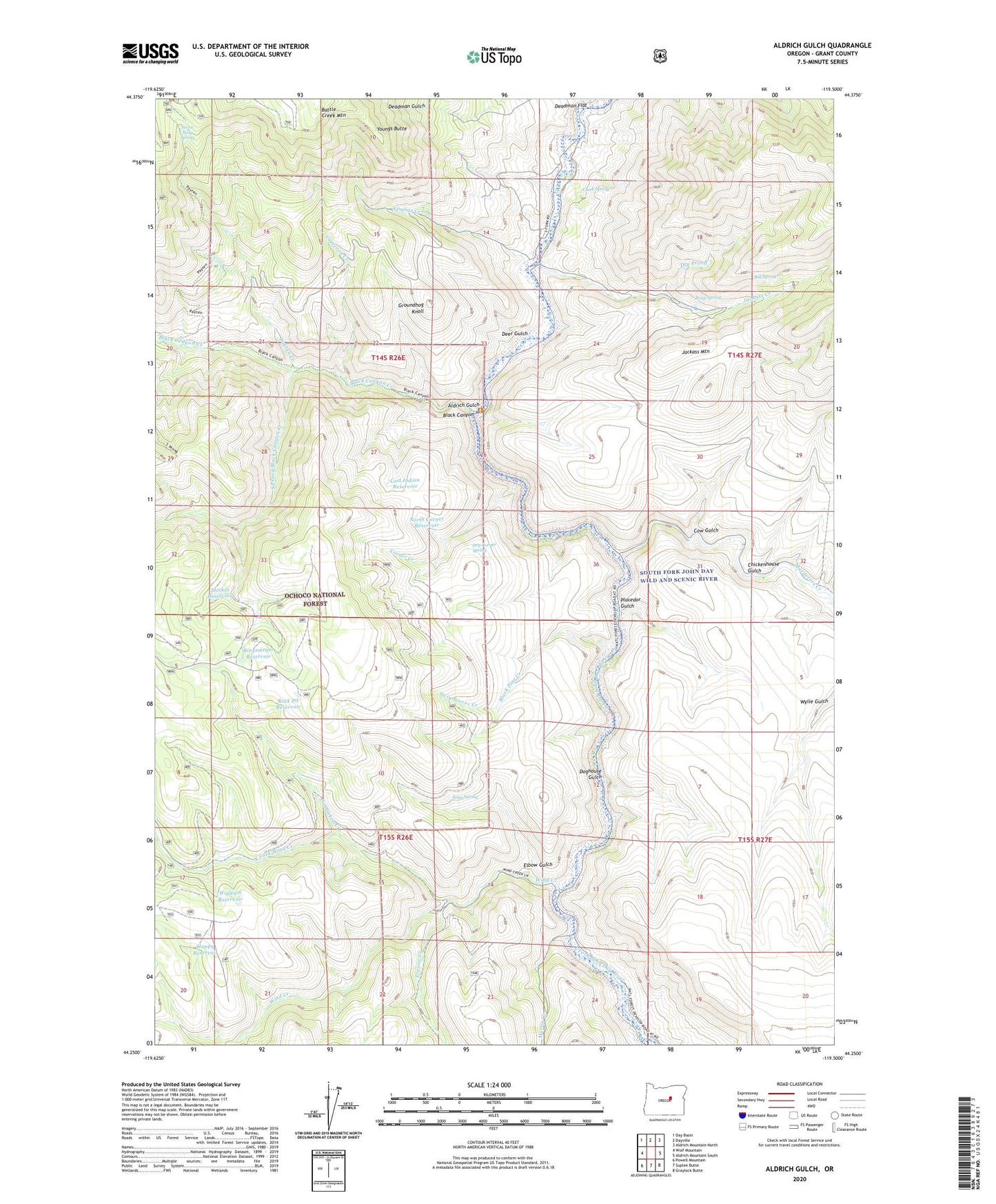
2024 topographic map quadrangle Aldrich Gulch in the state of Oregon. Scale: 1:24000. Based on the newly updated USGS 7.5' US Topo map series, this map is in the following counties: Grant. The map contains contour data, water features, and other items you are used to seeing on USGS maps, but also has updated roads and other features. This is the next generation of topographic maps. Printed on high-quality waterproof paper with UV fade-resistant inks.
Quads adjacent to this one:
West: Wolf Mountain
Northwest: Day Basin
North: Dayville
Northeast: Aldrich Mountain North
East: Aldrich Mountain South
Southeast: Graylock Butte
South: Suplee Butte
Southwest: Powell Mountain
This map covers the same area as the classic USGS quad with code o44119c5.
Contains the following named places: Aldrich Gulch, Big Spring, Black Canyon, Black Canyon Creek, Black Canyon Ranch, Black Pine Creek, Cameron Creek, Chickenhouse Gulch, Clark Spring, Congleton Creek, Corner Creek, Cow Gulch, Deadman Flat, Deer Gulch, Doghouse Gulch, Dry Corner Spring, Dry Prong, Elbow Gulch, Frazier Creek, Groundhog Knoll, Happy Reservoir, Jackass Creek, Jackass Mountain, Lost Indian Reservoir, Lost Indian Trail, Martin Creek, Murderers Creek, North Corner Reservoir, North Fork Wind Creek, Payten Creek, Payten Trail, Pine Tree Campground, Placedor Gulch, Ringsmeyer Reservoir, Rock Pit Reservoir, Rockpile Ranch, Roop Spring, Seven Sixty Reservoir, Seven Sixty Spring, Soup Spring, South Prong Black Canyon Creek, Sundstrom Place, Thicket Reservoir, Twin Stoves Creek, Wigwam Reservoir, Wind Creek, Youngs Butte, Youngs Creek