MyTopo
Bacona Oregon US Topo Map
Couldn't load pickup availability
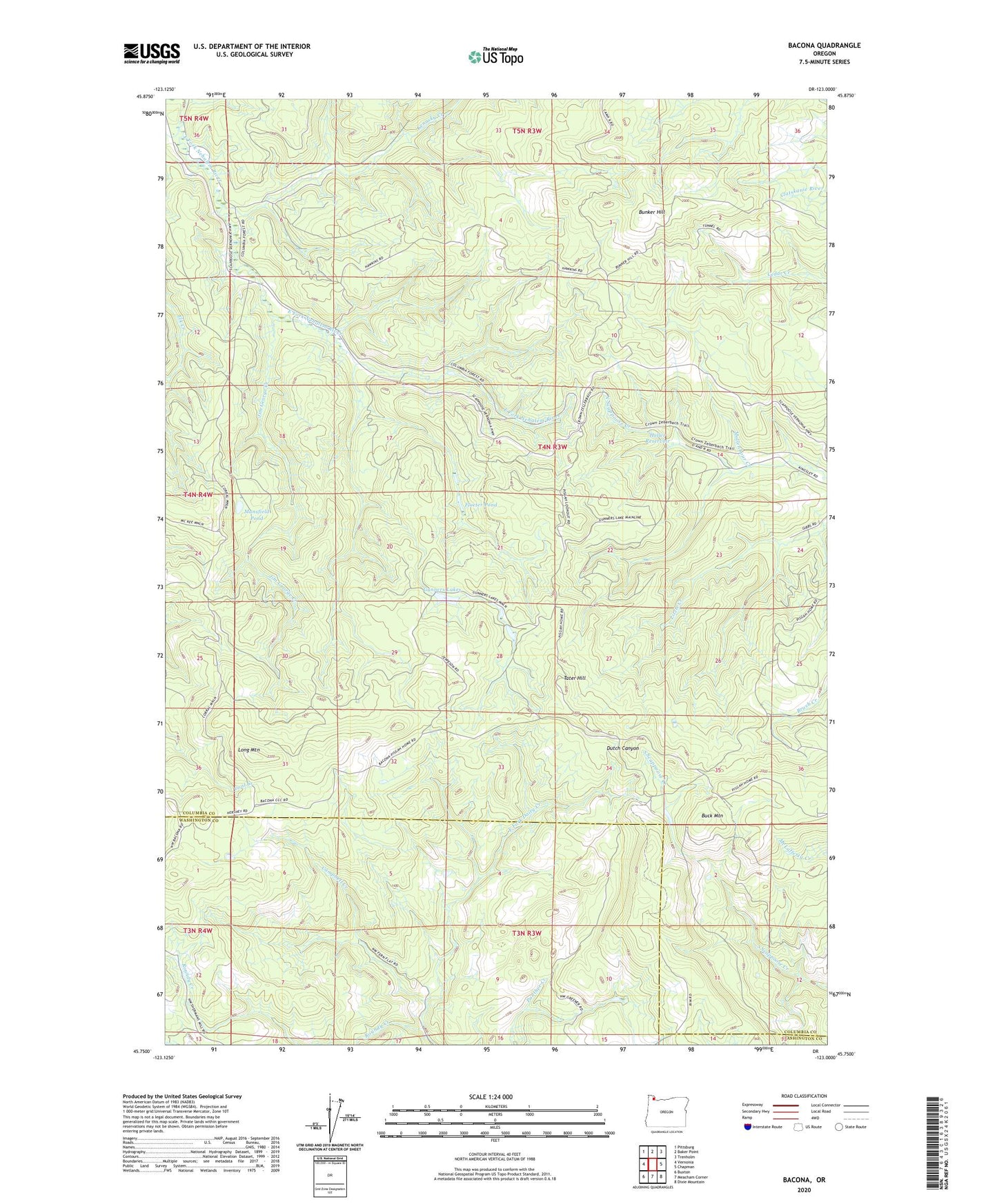
2020 topographic map quadrangle Bacona in the state of Oregon. Scale: 1:24000. Based on the newly updated USGS 7.5' US Topo map series, this map is in the following counties: Columbia, Washington. The map contains contour data, water features, and other items you are used to seeing on USGS maps, but also has updated roads and other features. This is the next generation of topographic maps. Printed on high-quality waterproof paper with UV fade-resistant inks.
Quads adjacent to this one:
West: Vernonia
Northwest: Pittsburg
North: Baker Point
Northeast: Trenholm
East: Chapman
Southeast: Dixie Mountain
South: Meacham Corner
Southwest: Buxton
Contains the following named places: Bacona, Buck Mountain, Bunker Hill, Campbell Creek, Dog Creek, Floeter Pond, Greener Road Trail, Gunners Lakes, Hawkins Pit, Heller Reservoir, Jim George Creek, Kenusky Creek, Long Mountain, Mansfield Lookout, Mansfield Pond, Mollenhour Creek, Pisgah Lookout, Roundy Creek, Scaponia Campground, Tater Hill, Wilark Post Office