MyTopo
Buxton Oregon US Topo Map
Couldn't load pickup availability
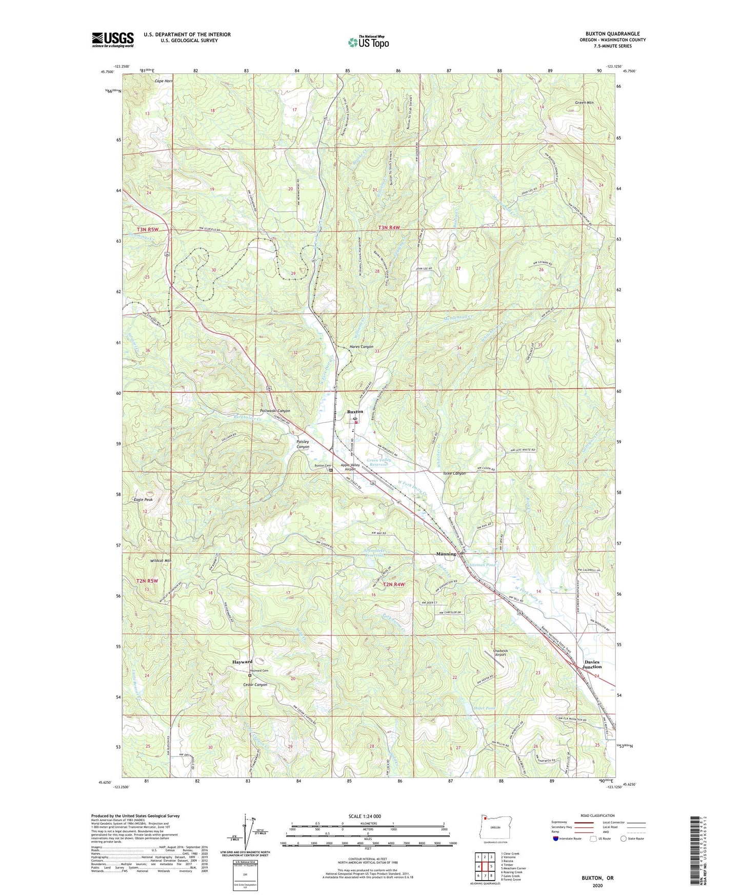
2023 topographic map quadrangle Buxton in the state of Oregon. Scale: 1:24000. Based on the newly updated USGS 7.5' US Topo map series, this map is in the following counties: Washington. The map contains contour data, water features, and other items you are used to seeing on USGS maps, but also has updated roads and other features. This is the next generation of topographic maps. Printed on high-quality waterproof paper with UV fade-resistant inks.
Quads adjacent to this one:
West: Timber
Northwest: Clear Creek
North: Vernonia
Northeast: Bacona
East: Meacham Corner
Southeast: Forest Grove
South: Gales Creek
Southwest: Roaring Creek
This map covers the same area as the classic USGS quad with code o45123f2.
Contains the following named places: Apple Valley Airport, Bacona Post Office, Banks Christian Academy, Banks Fire Protection District 13 Buxton Station, Banks-Vernonia State Trail, Bays Farm, Broke Again Farms, Brooke Creek, Burgholzer Creek, Buxton, Buxton Community Cemetery, Buxton Creek, Buxton Lookout Tower, Buxton Post Office, Buxton Station, Cape Horn, Carstens, Chadwick Airport, Chiltern Spur, Clayhill, Crawford, Cummings Creek, Davies Junction, DuBois, Eagle Peak, Fashion, Garrigus Creek, Green Mountain, Green Valley Reservoir, Hare, Hares Canyon, Hayward, Hayward Cemetery, Hayward Post Office, Hofer Pond, J Cole Logging Company, Kuder Creek, L L Stub Stewart State Park, Logging Creek, Manning, Manning Post Office, Mendenhall Creek, Neely Ranch, Paisley Canyon, Poliwaski Canyon, Rock Creek, Schmadeke Reservoir, Scofield, Scofield Post Office, Staleys Junction, Standard Box and Lumber Company, Strassel, Strassel Creek, Strassel Post Office, Thornburg, Tolke Canyon, Whitcher Creek, Whiteman Pond, Whittseley and Wisk, Wildcat Mountain, Williams Creek, Wirfs, ZIP Codes: 97109, 97125