
MyTopo
Balm Canyon Oregon US Topo Map
Couldn't load pickup availability
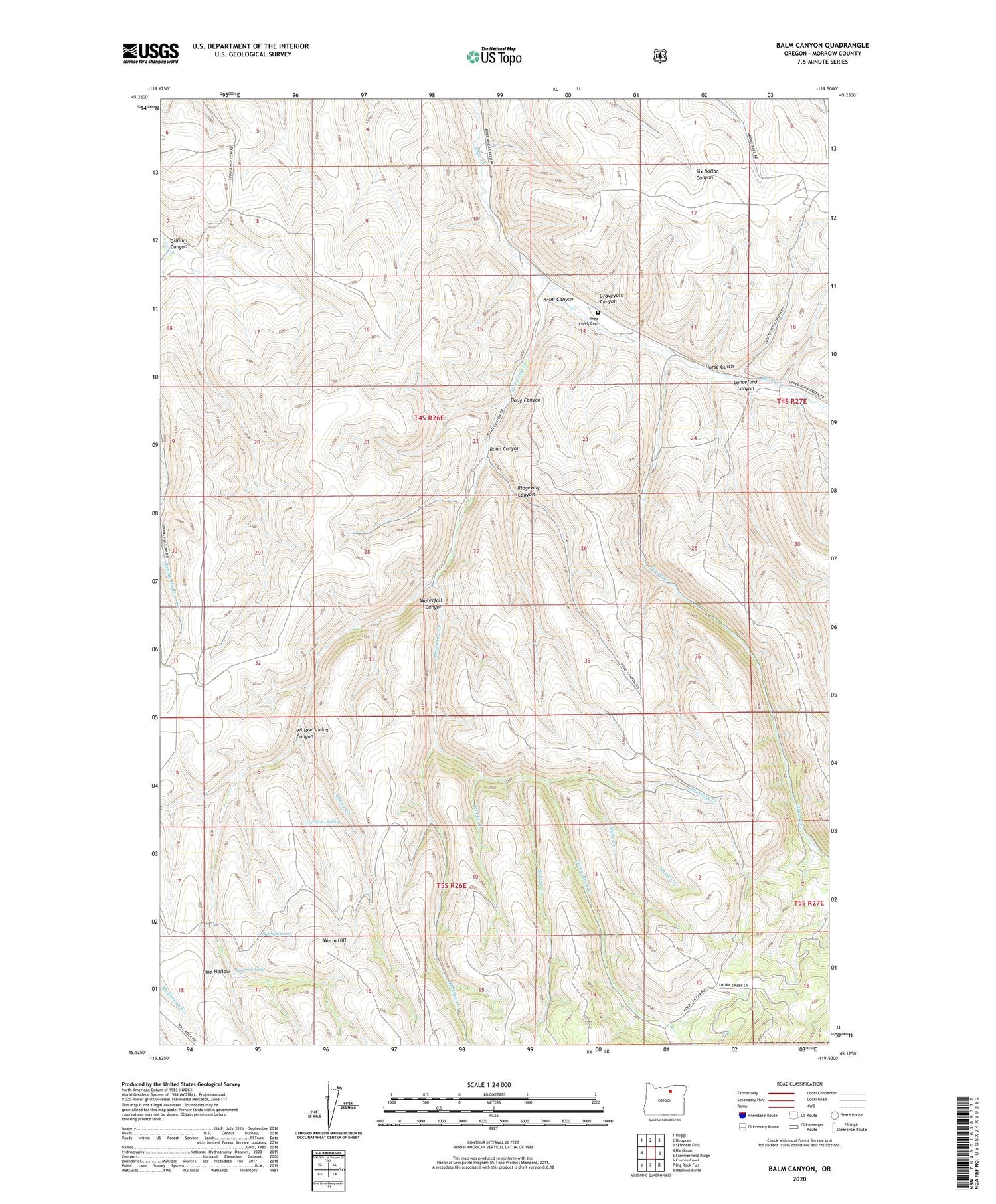
2020 topographic map quadrangle Balm Canyon in the state of Oregon. Scale: 1:24000. Based on the newly updated USGS 7.5' US Topo map series, this map is in the following counties: Morrow. The map contains contour data, water features, and other items you are used to seeing on USGS maps, but also has updated roads and other features. This is the next generation of topographic maps. Printed on high-quality waterproof paper with UV fade-resistant inks.
Quads adjacent to this one:
West: Hardman
Northwest: Ruggs
North: Heppner
Northeast: Skinners Fork
East: Summerfield Ridge
Southeast: Madison Butte
South: Big Rock Flat
Southwest: Chapin Creek
Contains the following named places: Balm Canyon, Doug Canyon, Gene Creek, Gilliam Canyon, Graveyard Canyon, Gravy Creek, Hackman Creek, Horse Gulch, Houselog Creek, Lowen Spring, Lunceford Canyon, Pine Hollow, Rhea Creek Cemetery, Ridgeway Canyon, Road Canyon, Rocky Creek, Saling Spring, Sperry Creek, Thorn Creek, Three Rock Creek, Warm Hill, Waterfall Canyon, Willow Spring, Willow Spring Canyon, Wood Creek


