MyTopo
Bannock Ridge Oregon US Topo Map
Couldn't load pickup availability
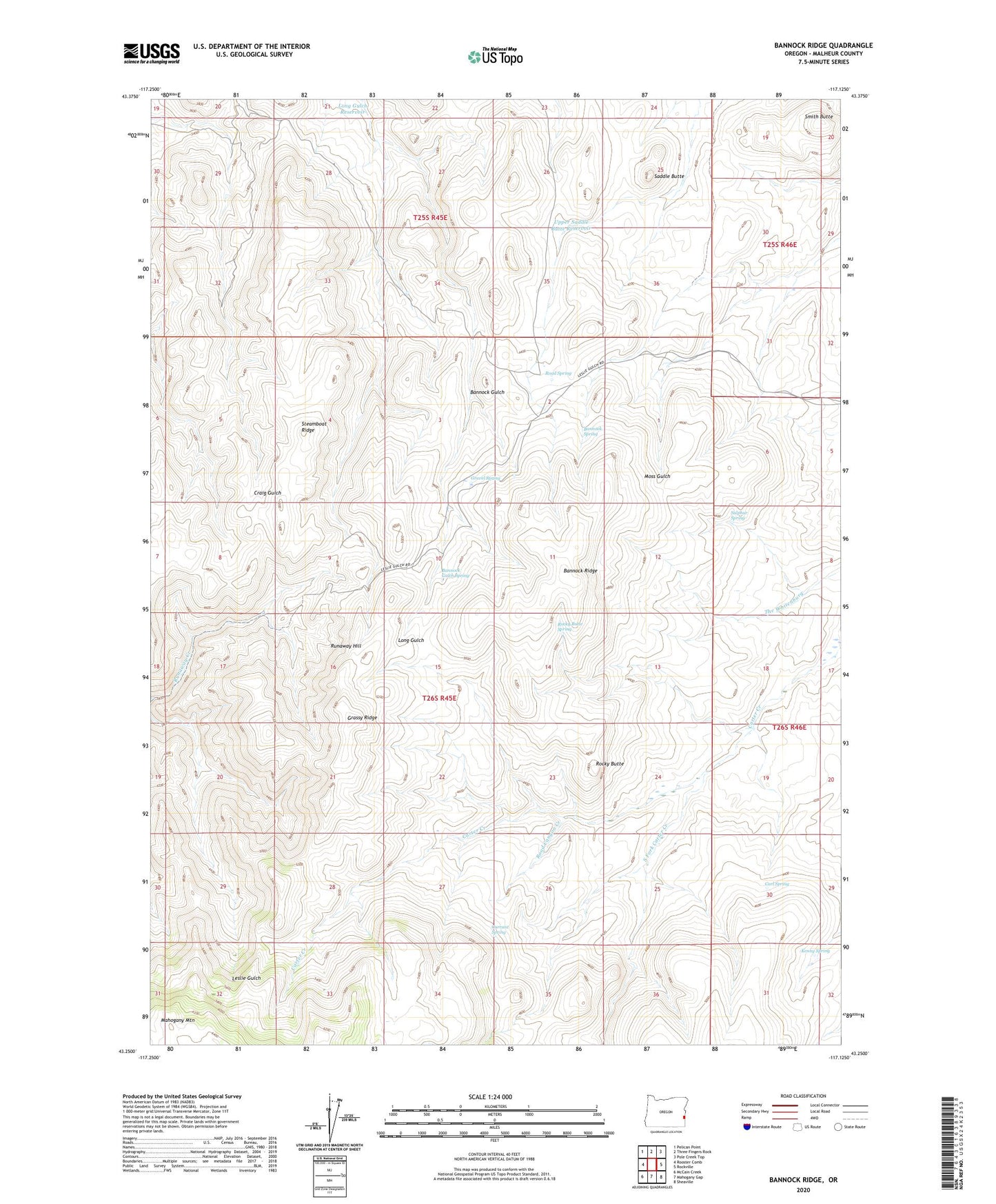
2023 topographic map quadrangle Bannock Ridge in the state of Oregon. Scale: 1:24000. Based on the newly updated USGS 7.5' US Topo map series, this map is in the following counties: Malheur. The map contains contour data, water features, and other items you are used to seeing on USGS maps, but also has updated roads and other features. This is the next generation of topographic maps. Printed on high-quality waterproof paper with UV fade-resistant inks.
Quads adjacent to this one:
West: Rooster Comb
Northwest: Pelican Point
North: Three Fingers Rock
Northeast: Pole Creek Top
East: Rockville
Southeast: Sheaville
South: Mahogany Gap
Southwest: McCain Creek
This map covers the same area as the classic USGS quad with code o43117c2.
Contains the following named places: Bannock Gulch, Bannock Gulch Spring, Bannock Ridge, Bannock Spring, Brooks Cabin, Carl Spring, Currant Spring, Grassy Ridge, Gravel Spring, Kenny Spring, Road Canyon Creek, Road Spring, Rocky Butte, Rocky Butte Spring, Runaway Hill, Saddle Butte, Smith Butte, South Fork Carter Creek, Steamboat Ridge, Sulphur Spring, Upper Saddle Butte Reservoir