MyTopo
Three Fingers Rock Oregon US Topo Map
Couldn't load pickup availability
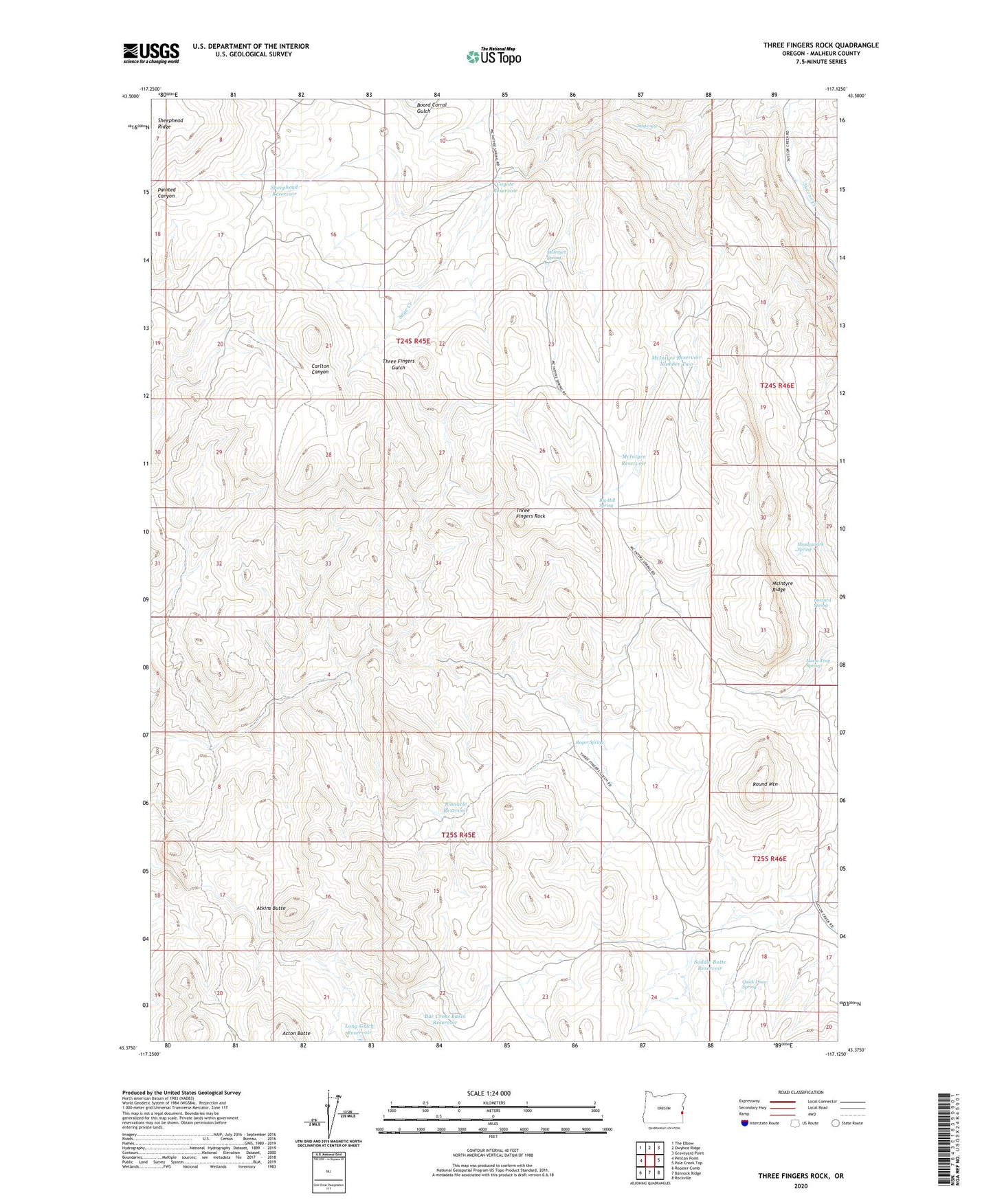
2023 topographic map quadrangle Three Fingers Rock in the state of Oregon. Scale: 1:24000. Based on the newly updated USGS 7.5' US Topo map series, this map is in the following counties: Malheur. The map contains contour data, water features, and other items you are used to seeing on USGS maps, but also has updated roads and other features. This is the next generation of topographic maps. Printed on high-quality waterproof paper with UV fade-resistant inks.
Quads adjacent to this one:
West: Pelican Point
Northwest: The Elbow
North: Owyhee Ridge
Northeast: Graveyard Point
East: Pole Creek Top
Southeast: Rockville
South: Bannock Ridge
Southwest: Rooster Comb
This map covers the same area as the classic USGS quad with code o43117d2.
Contains the following named places: Acton Butte, Atkins Butte, Bar Cross Basin Reservoir, Big Hill Spring, Board Corral Gulch, Buzzard Spring, Camp Cabin, Coyote Reservoir, Horse Trap Spring, Long Gulch Reservoir, McIntyre Reservoir, McIntyre Reservoir Number Two, McIntyre Ridge, McIntyre Spring, Meadowlark Spring, Pinnacle Reservoir, Quick Draw Spring, Roger Spring, Round Mountain, Saddle Butte Reservoir, Sheephead Reservoir, Succor Creek State Park, Three Fingers Rock