MyTopo
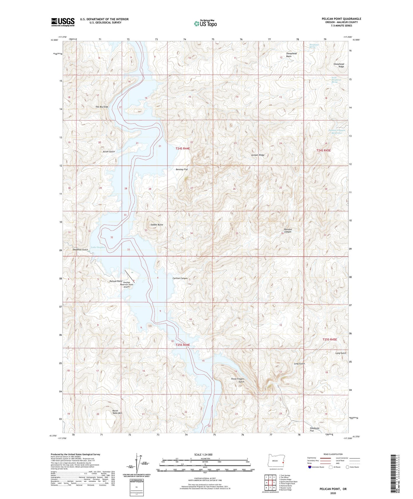
Pelican Point Oregon US Topo Map
Couldn't load pickup availability
2024 topographic map quadrangle Pelican Point in the state of Oregon. Scale: 1:24000. Based on the newly updated USGS 7.5' US Topo map series, this map is in the following counties: Malheur. The map contains contour data, water features, and other items you are used to seeing on USGS maps, but also has updated roads and other features. This is the next generation of topographic maps. Printed on high-quality waterproof paper with UV fade-resistant inks.
Quads adjacent to this one:
West: Quartz Mountain Basin
Northwest: Twin Springs
North: The Elbow
Northeast: Owyhee Ridge
East: Three Fingers Rock
Southeast: Bannock Ridge
South: Rooster Comb
Southwest: Diamond Butte
This map covers the same area as the classic USGS quad with code o43117d3.
Contains the following named places: Acton Gulch, Bensley Flat, Carlton Canyon, Deadman Gulch, Honeycombs, Juniper Ridge, Long Gulch, North Table Mountain, Owyhee Reservoir State Airport, Painted Canyon, Painted Canyon Reservoir, Pelican Point, Perkins Flat, Saddle Butte, Sheephead Basin, Sheephead Ridge, Sheephead Spring, South Sheephead Spring, The Big Slide, Three Fingers Gulch