MyTopo
Rockville Oregon US Topo Map
Couldn't load pickup availability
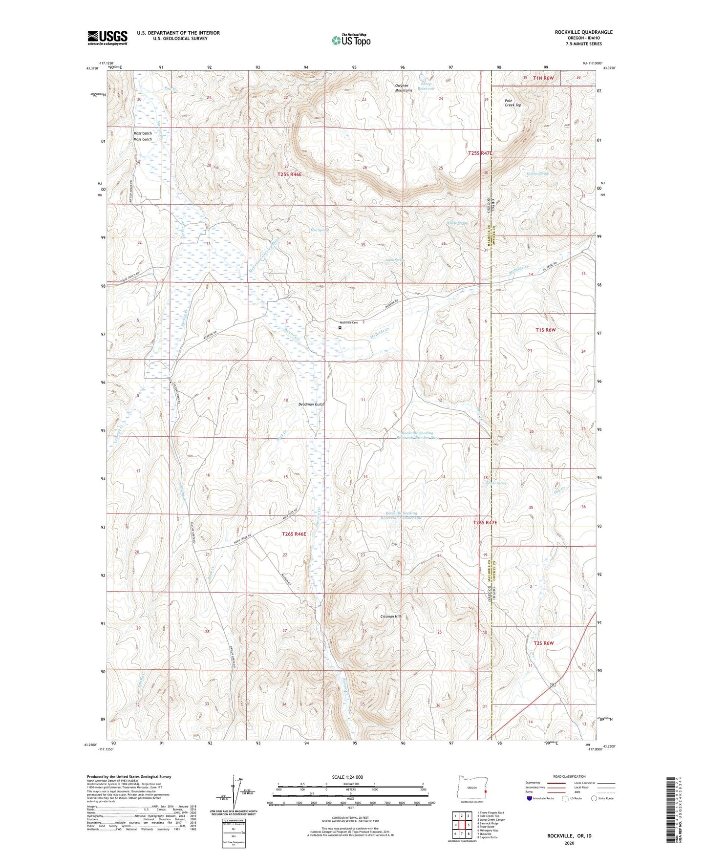
2023 topographic map quadrangle Rockville in the states of Oregon, Idaho. Scale: 1:24000. Based on the newly updated USGS 7.5' US Topo map series, this map is in the following counties: Malheur, Owyhee. The map contains contour data, water features, and other items you are used to seeing on USGS maps, but also has updated roads and other features. This is the next generation of topographic maps. Printed on high-quality waterproof paper with UV fade-resistant inks.
Quads adjacent to this one:
West: Bannock Ridge
Northwest: Three Fingers Rock
North: Pole Creek Top
Northeast: Jump Creek Canyon
East: Piute Butte
Southeast: Captain Butte
South: Sheaville
Southwest: Mahogany Gap
This map covers the same area as the classic USGS quad with code o43117c1.
Contains the following named places: Carter Creek, Carter Post Office, Crisman Hill, Dead Horse Creek, Deadman Gulch, Dogs Reservoir, Dry Creek, Greeley Ranch, Holmes Spring, Lamb Spring, McBride Creek, McKenzie-Greeley Ditch, Moss Gulch, Mud Spring, Oreida Spring, Pole Creek, Pole Creek Top, Rock Creek, Rockville, Rockville Cemetery, Rockville Elementary School, Rockville Post Office, Rockville Seeding Reservoir Number One, Rockville Seeding Reservoir Number Two, Sheep Reservoir, Spring Creek, Strode Ditch, The Rocks, The Whitenburg, Willow Spring