MyTopo
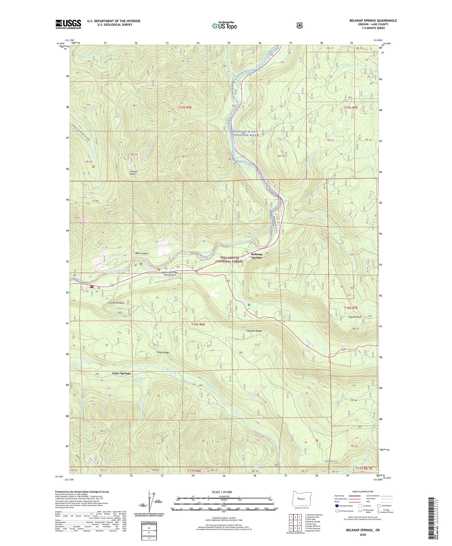
Belknap Springs Oregon US Topo Map
Couldn't load pickup availability
Also explore the Belknap Springs Forest Service Topo of this same quad for updated USFS data
2023 topographic map quadrangle Belknap Springs in the state of Oregon. Scale: 1:24000. Based on the newly updated USGS 7.5' US Topo map series, this map is in the following counties: Lane. The map contains contour data, water features, and other items you are used to seeing on USGS maps, but also has updated roads and other features. This is the next generation of topographic maps. Printed on high-quality waterproof paper with UV fade-resistant inks.
Quads adjacent to this one:
West: McKenzie Bridge
Northwest: Carpenter Mountain
North: Tamolitch Falls
Northeast: Clear Lake
East: Linton Lake
Southeast: Substitute Point
South: French Mountain
Southwest: Cougar Reservoir
This map covers the same area as the classic USGS quad with code o44122b1.
Contains the following named places: Avenue Creek, Belknap Camp, Belknap Hot Spring, Belknap Springs, Belknap Springs Post Office, Blue Canyon, Boulder Creek, Cedar Swamp Creek, Cupola Rock, Deer Creek, Dry Creek, Foley Hot Springs, Foley Springs, Foley Springs Post Office, Frissell Creek, Frissell Point, Haflinger Creek, Harvard Creek, Hot Spring, Lakes End Recreation Site, Limberlost Recreation Site, Little Smokey, Lost Creek, McKenzie Bridge State Airport, McKenzie River National Recreational Trail, McKenzie River Ranger Station, North Fork Boulder Creek, Norwegian Creek, Paradise Campground Boat Ramp, Paradise Recreation Site, Rainbow Creek, Rainbow Falls, Scott Creek, Spring Creek, Twisty Creek, United States Forest Service McKenzie River Ranger District, White Branch, Wilelada Creek