MyTopo
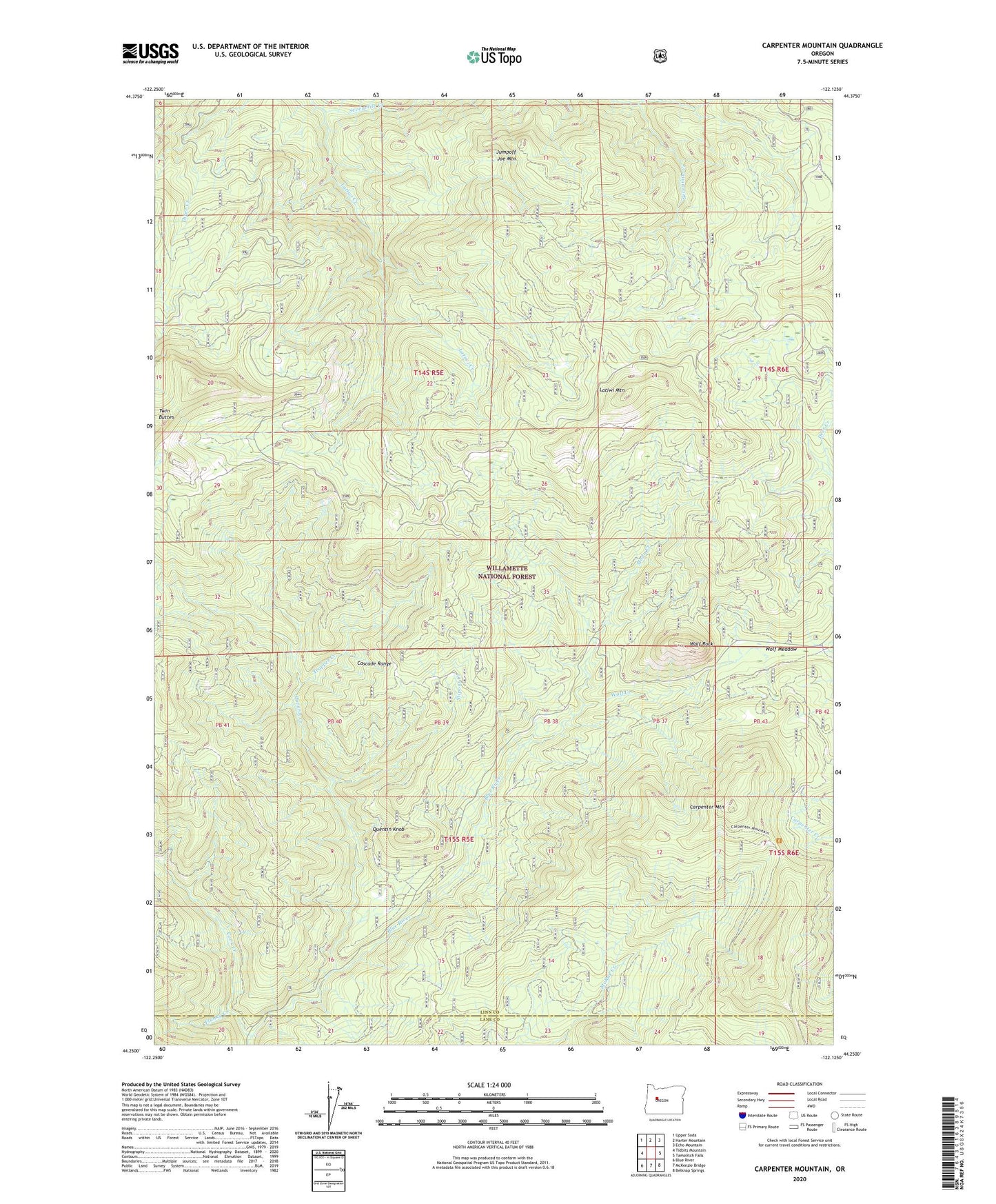
Carpenter Mountain Oregon US Topo Map
Couldn't load pickup availability
Also explore the Carpenter Mountain Forest Service Topo of this same quad for updated USFS data
2023 topographic map quadrangle Carpenter Mountain in the state of Oregon. Scale: 1:24000. Based on the newly updated USGS 7.5' US Topo map series, this map is in the following counties: Linn, Lane. The map contains contour data, water features, and other items you are used to seeing on USGS maps, but also has updated roads and other features. This is the next generation of topographic maps. Printed on high-quality waterproof paper with UV fade-resistant inks.
Quads adjacent to this one:
West: Tidbits Mountain
Northwest: Upper Soda
North: Harter Mountain
Northeast: Echo Mountain
East: Tamolitch Falls
Southeast: Belknap Springs
South: McKenzie Bridge
Southwest: Blue River
This map covers the same area as the classic USGS quad with code o44122c2.
Contains the following named places: Burnside Creek, Cadenza Creek, Carpenter Mountain, Cook Creek, Flunky Creek, Jumpoff Joe Mountain, Latiwi Creek, Latiwi Mountain, Mann Creek, North Fork Cook Creek, Quentin Creek, Quentin Knob, Sevenmile Creek, Slipout Creek, Three Creek Trail, Trapper Creek, Twin Buttes, Wolf Creek, Wolf Meadow, Wolf Rock