MyTopo
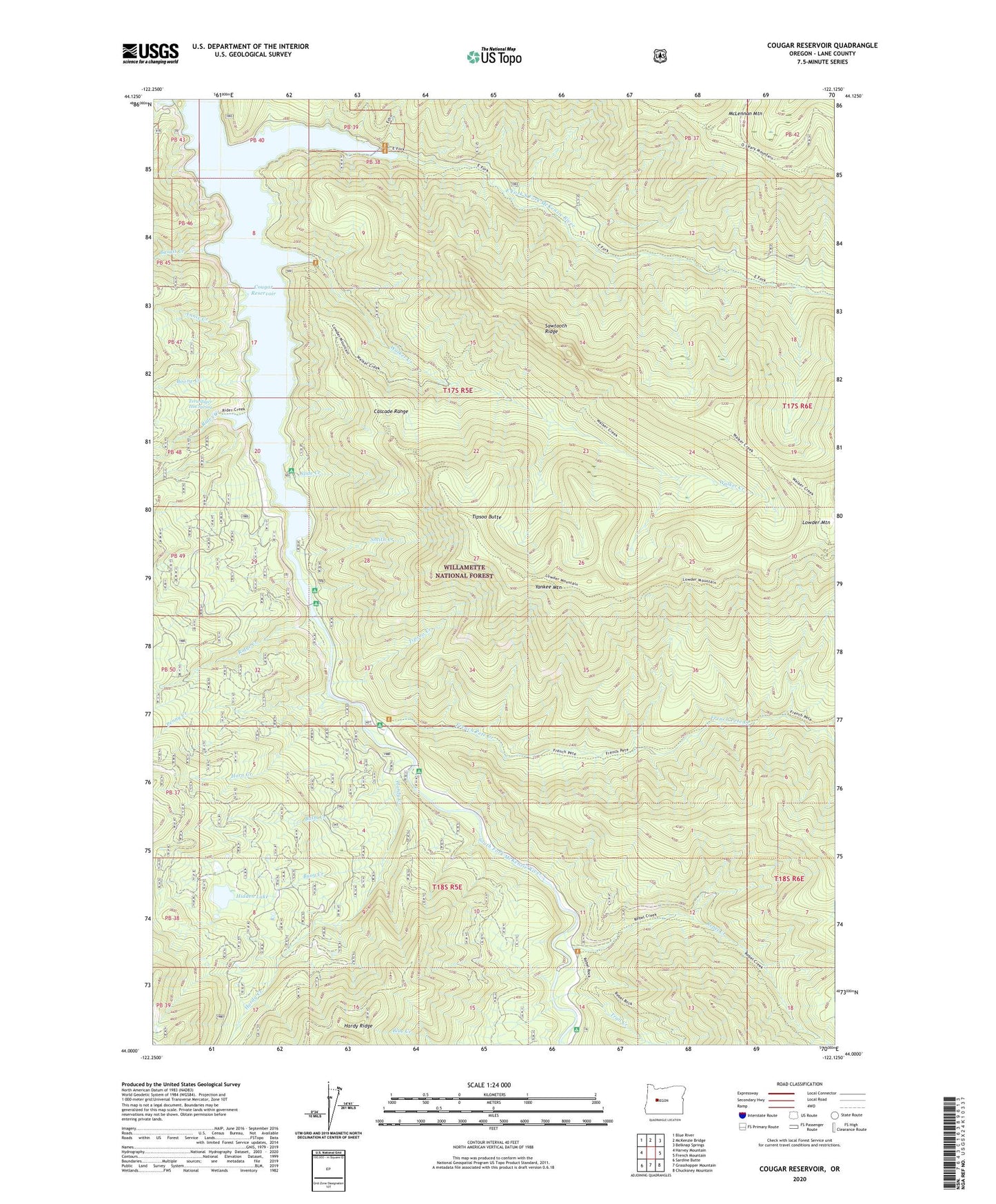
Cougar Reservoir Oregon US Topo Map
Couldn't load pickup availability
Also explore the Cougar Reservoir Forest Service Topo of this same quad for updated USFS data
2024 topographic map quadrangle Cougar Reservoir in the state of Oregon. Scale: 1:24000. Based on the newly updated USGS 7.5' US Topo map series, this map is in the following counties: Lane. The map contains contour data, water features, and other items you are used to seeing on USGS maps, but also has updated roads and other features. This is the next generation of topographic maps. Printed on high-quality waterproof paper with UV fade-resistant inks.
Quads adjacent to this one:
West: Harvey Mountain
Northwest: Blue River
North: McKenzie Bridge
Northeast: Belknap Springs
East: French Mountain
Southeast: Chucksney Mountain
South: Grasshopper Mountain
Southwest: Sardine Butte
This map covers the same area as the classic USGS quad with code o44122a2.
Contains the following named places: Annie Creek, Balm Creek, Basalt Creek, Boone Creek, Buoy Creek, Cougar Cossing, Cougar Crossing Recreation Site, Cougar Reservoir, East Fork South Fork McKenzie River, East Fork/Echo Recreation Site, Echo / East Fork Boat Ramp, French Pete Creek, French Pete Recreation Site, Hard Rock Recreation Site, Hardy Creek, Hidden Lake, Horn Creek, Lowder Mountain, McKenzie River Division, McLennan Mountain, Penny Creek, Rebel Creek, Red Diamond Recreation Site, Rider Creek, Ridge Creek, Sawtooth Ridge, Slide Creek, Slide Creek Boat Ramp, Slide Creek Recreation Site, Smith Creek, Sunnyside Recreation Site, Terwilliger Hot Spring, Terwilliger Hot Springs Recreation Site, Tipsoo Butte, Tipsoo Creek, Tipsoo Trail, Trail Creek, Walker Creek, Willamette National Forest, Yankee Creek, Yankee Mountain