MyTopo
Benham Falls Oregon US Topo Map
Couldn't load pickup availability
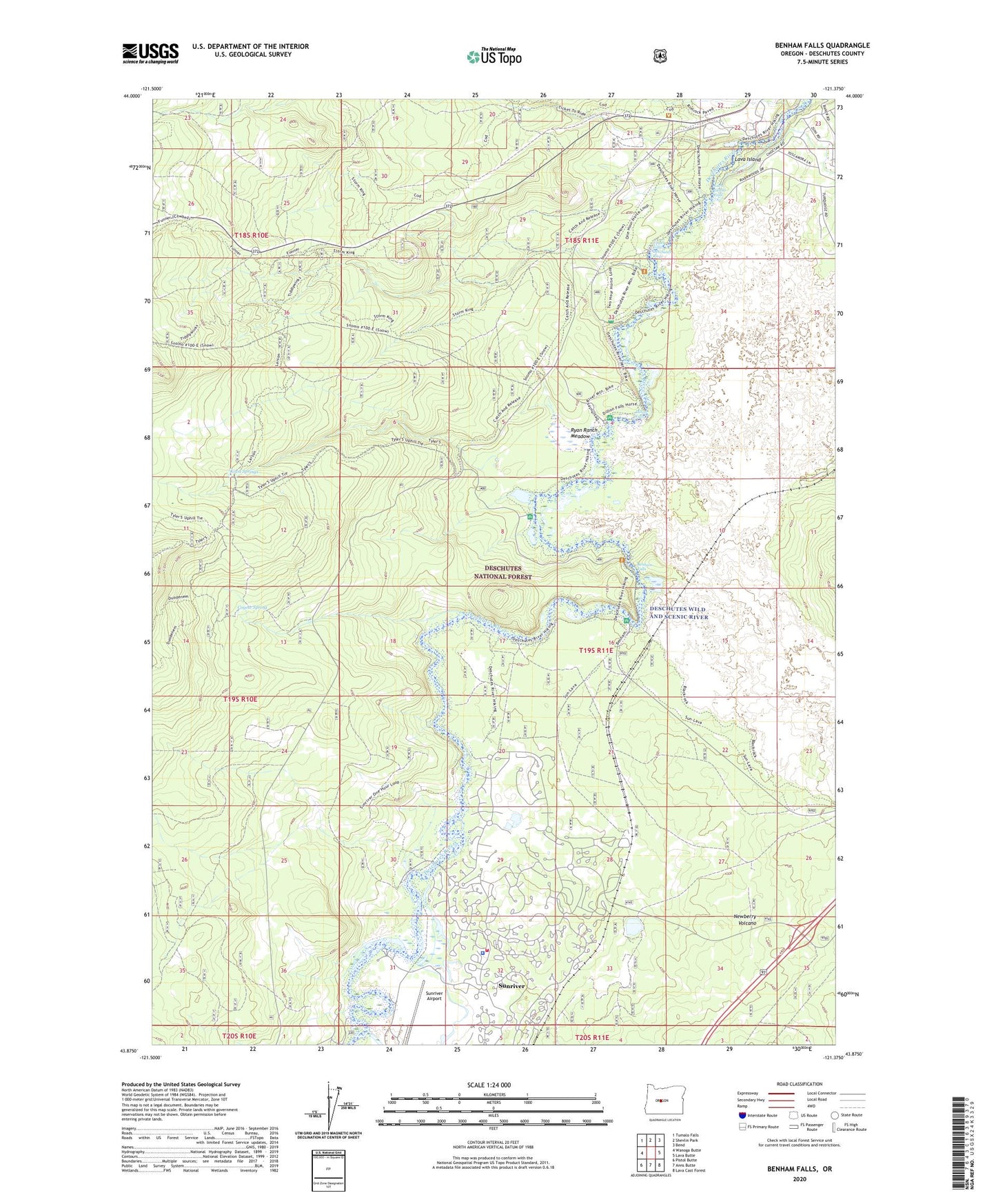
2020 topographic map quadrangle Benham Falls in the state of Oregon. Scale: 1:24000. Based on the newly updated USGS 7.5' US Topo map series, this map is in the following counties: Deschutes. The map contains contour data, water features, and other items you are used to seeing on USGS maps, but also has updated roads and other features. This is the next generation of topographic maps. Printed on high-quality waterproof paper with UV fade-resistant inks.
Quads adjacent to this one:
West: Wanoga Butte
Northwest: Tumalo Falls
North: Shevlin Park
Northeast: Bend
East: Lava Butte
Southeast: Lava Cast Forest
South: Anns Butte
Southwest: Pistol Butte
Contains the following named places: Aspen Recreation Site, Benham Falls, Benham Falls Boat Launch, Benham Falls Recreation Site, Benham Falls West Recreation Site, Besson Boating Site, Besson Camp Recreation Site, Besson Day Use Boat Launch, Big Eddy Recreation Site, Coyote Spring, Dillon Falls, Dillon Falls Boat Ramp, Dillon Falls Recreation Site, Inn of the Seventh Mountain Outdoor Ice Rink, Kiwa Springs, Lava, Lava Butte Geological Area, Lava Island, Lava Island Falls, Lava Island Recreation Site, Lava Island Shelter, Lava Junction, Meadow Recreation Site, Meadows Golf Course, Rock Viewpoint, Ryan Ranch Meadow, Seventh Mountain Resort, Shonquest Ranch, Slough Camp Boat Launch, Slough Recreation Site, Sunriver, Sunriver Airport, Sunriver Aquatic and Recreation Center Amphitheatre, Sunriver Census Designated Place, Sunriver Environmental, Sunriver Fire Department, Sunriver Homeowners Association Public Works Building, Sunriver Nature Center and Observatory, Sunriver Police Department, Sunriver Resort Marina, Sunriver Resort Marina Boat Launch, Upper Falls Deschutes River, Woodlands Golf Course