MyTopo
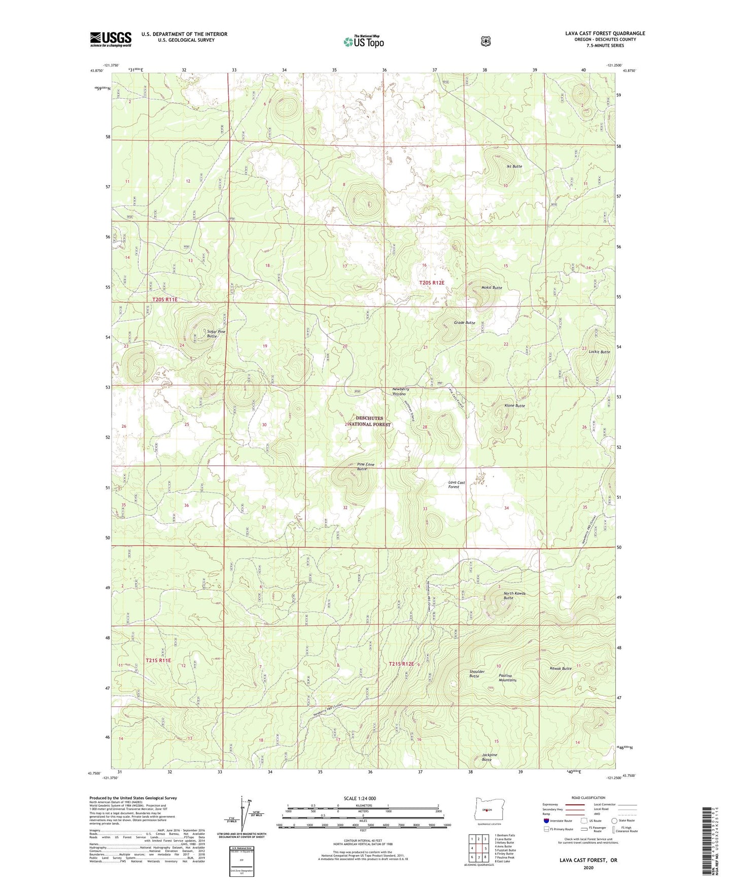
Lava Cast Forest Oregon US Topo Map
Couldn't load pickup availability
Also explore the Lava Cast Forest Forest Service Topo of this same quad for updated USFS data
2024 topographic map quadrangle Lava Cast Forest in the state of Oregon. Scale: 1:24000. Based on the newly updated USGS 7.5' US Topo map series, this map is in the following counties: Deschutes. The map contains contour data, water features, and other items you are used to seeing on USGS maps, but also has updated roads and other features. This is the next generation of topographic maps. Printed on high-quality waterproof paper with UV fade-resistant inks.
Quads adjacent to this one:
West: Anns Butte
Northwest: Benham Falls
North: Lava Butte
Northeast: Kelsey Butte
East: Fuzztail Butte
Southeast: East Lake
South: Paulina Peak
Southwest: Finley Butte
This map covers the same area as the classic USGS quad with code o43121g3.
Contains the following named places: Ada Butte, Galo Butte, Grade Butte, Ikt Butte, Jackpine Butte, Kawak Butte, Klone Butte, Lava Cast Forest, Lava Cast Forest Recreation Site, Lockit Butte, Mokst Butte, Newberry National Volcanic Monument, North Kawak Butte, Nota Butte, Pine Cone Butte, Puku Butte, Shoulder Butte, Sugar Pine Butte