MyTopo
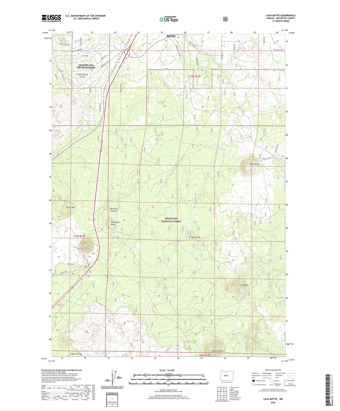
Lava Butte Oregon US Topo Map
Couldn't load pickup availability
Also explore the Lava Butte Forest Service Topo of this same quad for updated USFS data
2024 topographic map quadrangle Lava Butte in the state of Oregon. Scale: 1:24000. Based on the newly updated USGS 7.5' US Topo map series, this map is in the following counties: Deschutes. The map contains contour data, water features, and other items you are used to seeing on USGS maps, but also has updated roads and other features. This is the next generation of topographic maps. Printed on high-quality waterproof paper with UV fade-resistant inks.
Quads adjacent to this one:
West: Benham Falls
Northwest: Shevlin Park
North: Bend
Northeast: Bend Airport
East: Kelsey Butte
Southeast: Fuzztail Butte
South: Lava Cast Forest
Southwest: Anns Butte
This map covers the same area as the classic USGS quad with code o43121h3.
Contains the following named places: Arnold Canal, Baker Lake, Bend Golf and Country Club, Bessie Butte, Blacks Ranch, Deschutes River Woods, Deschutes River Woods Census Designated Place, Green Mountain, High Desert Museum, Huntington Butte, Klawhop Butte, Lava Butte, Lava Lands Visitor Center, Lava River Cave Recreation Site, Lost Tracks Golf Club, Luna Butte, Saiga Hill