MyTopo
Big Craggies Oregon US Topo Map
Couldn't load pickup availability
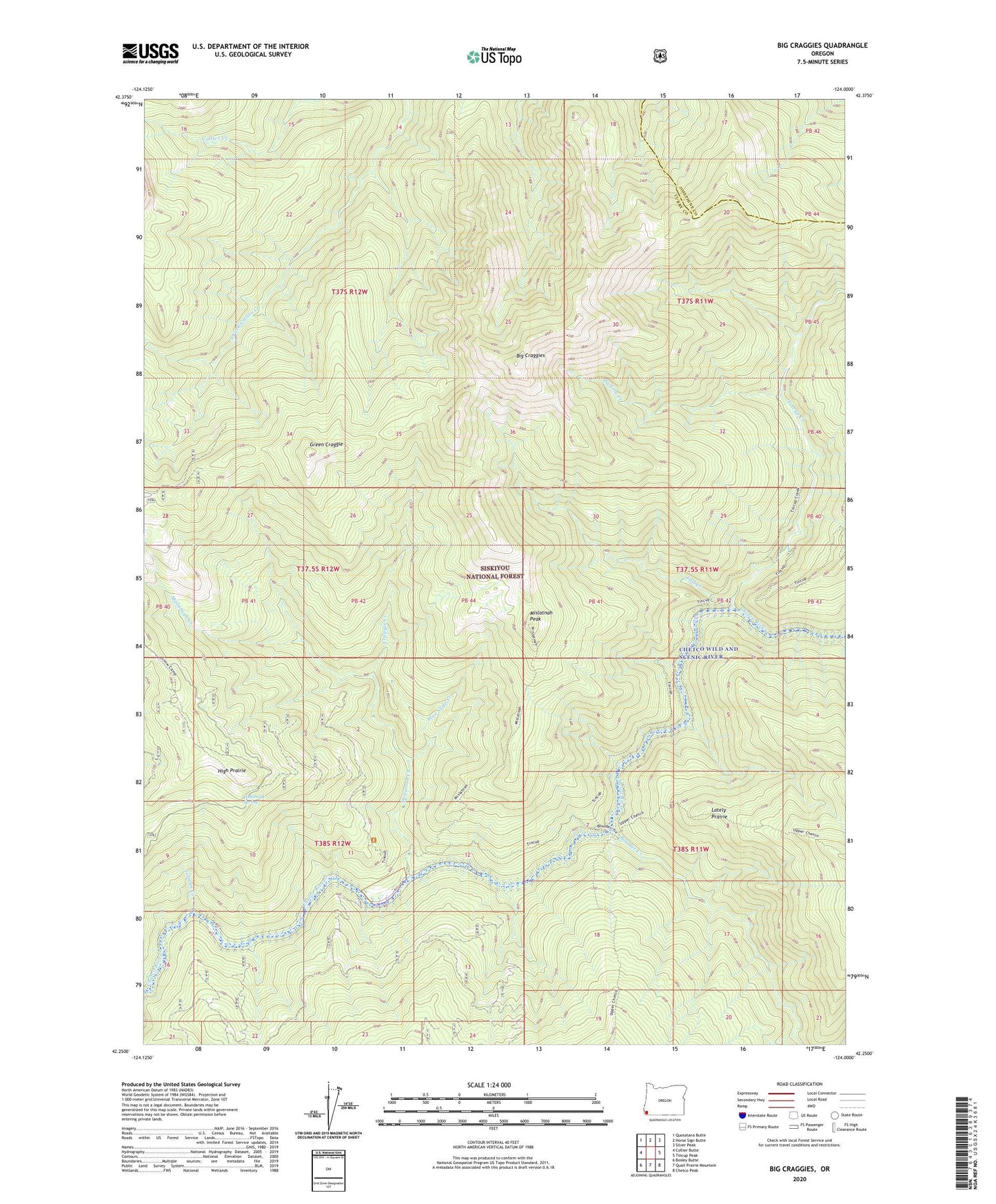
2020 topographic map quadrangle Big Craggies in the state of Oregon. Scale: 1:24000. Based on the newly updated USGS 7.5' US Topo map series, this map is in the following counties: Curry, Josephine. The map contains contour data, water features, and other items you are used to seeing on USGS maps, but also has updated roads and other features. This is the next generation of topographic maps. Printed on high-quality waterproof paper with UV fade-resistant inks.
Quads adjacent to this one:
West: Collier Butte
Northwest: Quosatana Butte
North: Horse Sign Butte
Northeast: Silver Peak
East: Tincup Peak
Southeast: Chetco Peak
South: Quail Prairie Mountain
Southwest: Bosley Butte
Contains the following named places: Big Craggies, Big Craggies Botanical Area, Blue Slide Creek, Chetco Wild and Scenic River, Collier Creek, Craggie Creek, Darling Creek, Fall Creek, Green Craggie, High Prairie, Humboldt Spring, Humboldt Spring Camp, Jacks Camp, Lately Prairie, Mislatnah Creek, Mislatnah Lookout, Mislatnah Peak, Tincup Creek, Tolman Creek, Tolman Ranch, Upper Mislatnah Prairie