MyTopo
Big Lookout Mountain Oregon US Topo Map
Couldn't load pickup availability
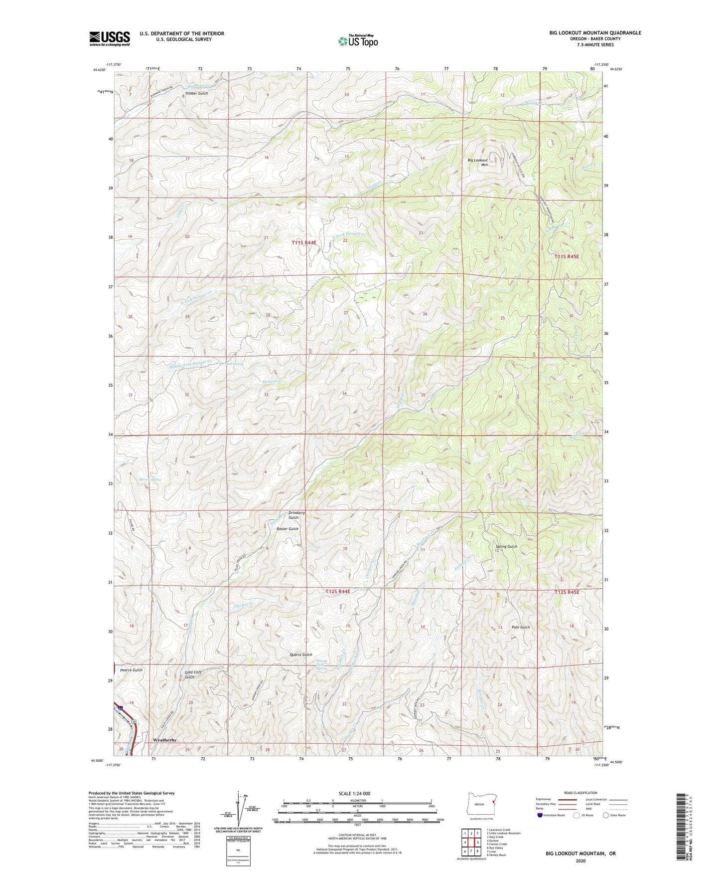
2023 topographic map quadrangle Big Lookout Mountain in the state of Oregon. Scale: 1:24000. Based on the newly updated USGS 7.5' US Topo map series, this map is in the following counties: Baker. The map contains contour data, water features, and other items you are used to seeing on USGS maps, but also has updated roads and other features. This is the next generation of topographic maps. Printed on high-quality waterproof paper with UV fade-resistant inks.
Quads adjacent to this one:
West: Durkee
Northwest: Lawrence Creek
North: Little Lookout Mountain
Northeast: Daly Creek
East: Connor Creek
Southeast: Henley Basin
South: Lime
Southwest: Rye Valley
This map covers the same area as the classic USGS quad with code o44117e3.
Contains the following named places: Barnes Spring, Big Lookout Mountain, Chicken Creek, Drindarry Gulch, Gold Cliff Gulch, Hawks Nest Spring, Marshall Creek, Mud Spring, Nelson Place, Nodine Creek, Pearce Gulch, Posthole Creek, Raster Gulch, Summit Creek, Timber Gulch, Weatherby School