MyTopo
Durkee Oregon US Topo Map
Couldn't load pickup availability
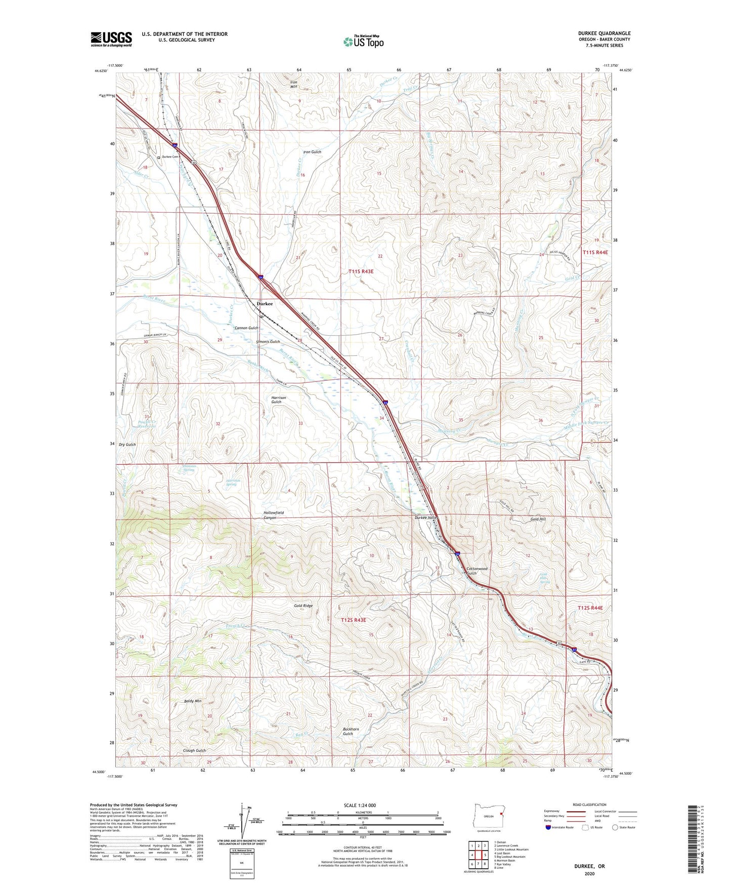
2023 topographic map quadrangle Durkee in the state of Oregon. Scale: 1:24000. Based on the newly updated USGS 7.5' US Topo map series, this map is in the following counties: Baker. The map contains contour data, water features, and other items you are used to seeing on USGS maps, but also has updated roads and other features. This is the next generation of topographic maps. Printed on high-quality waterproof paper with UV fade-resistant inks.
Quads adjacent to this one:
West: Lost Basin
Northwest: Oxman
North: Lawrence Creek
Northeast: Little Lookout Mountain
East: Big Lookout Mountain
Southeast: Lime
South: Rye Valley
Southwest: Mormon Basin
This map covers the same area as the classic USGS quad with code o44117e4.
Contains the following named places: Alder Creek, Baldy Mountain, Banks Ditch, Big Springs Creek, Buckhorn Gulch, Cannon Gulch, Cottonwood Gulch, Crandall Creek, Dry Gulch, Durkee, Durkee Cemetery, Durkee Creek, Durkee Post Office, Durkee Valley, French Creek, Gold Creek, Gold Hill, Gold Hill Spring, Gold Ridge, Gold Ridge Mine, Harrison Gulch, Harrison Spring, Hollowfield Canyon, Iron Gulch, Manning Creek, Middle Fork Swayze Creek, Moore Reservoir, Nelson, North Fork Swayze Creek, Plano Post Office, Plano School, Powell Creek Reservoir, Pritchard Creek, Rattlesnake Springs Wayside Park, Ray Creek, Shirttail Creek, Simonis Gulch, Simonis Spring, Swayze Creek, Trail Creek, ZIP Code: 97905