MyTopo
Cedar Mountain Oregon US Topo Map
Couldn't load pickup availability
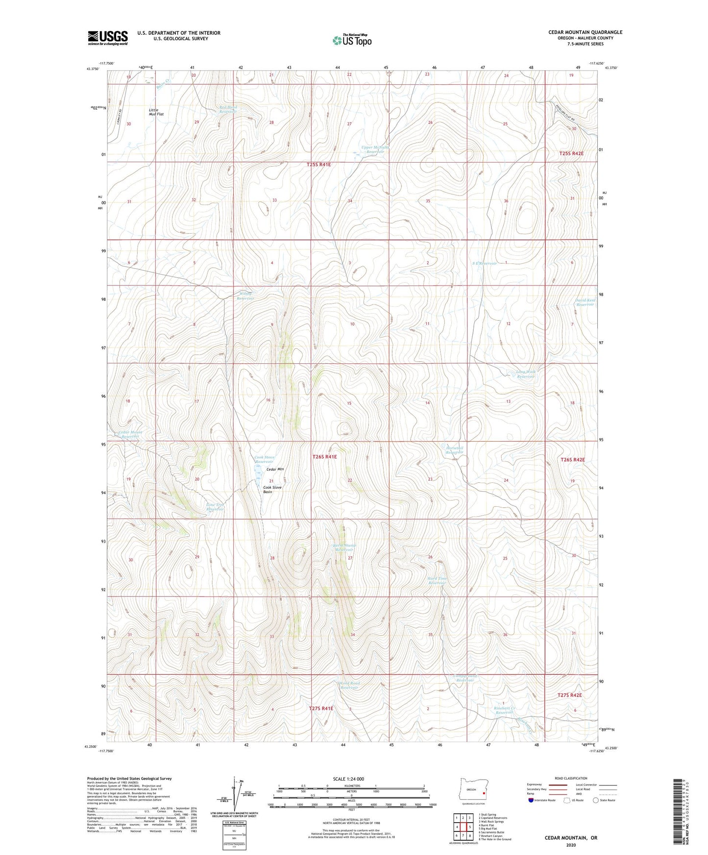
2023 topographic map quadrangle Cedar Mountain in the state of Oregon. Scale: 1:24000. Based on the newly updated USGS 7.5' US Topo map series, this map is in the following counties: Malheur. The map contains contour data, water features, and other items you are used to seeing on USGS maps, but also has updated roads and other features. This is the next generation of topographic maps. Printed on high-quality waterproof paper with UV fade-resistant inks.
Quads adjacent to this one:
West: Burnt Flat
Northwest: Skull Spring
North: Copeland Reservoirs
Northeast: Wall Rock Springs
East: Big Mud Flat
Southeast: The Hole in the Ground
South: Rinehart Canyon
Southwest: Sacramento Butte
This map covers the same area as the classic USGS quad with code o43117c6.
Contains the following named places: Burnt Stump Reservoir, Campground Reservoir, Cedar Mount Reservoir, Cedar Mountain, Cook Stove Basin, Cook Stove Reservoir, Hard Time Reservoir, Horsetail Reservoir, Little Mud Flat, Lone Tree Reservoir, Long Walk Reservoir, Red Head Reservoir, Rinehart Creek Reservoir, S E Reservoir, Upper McNulty Reservoir, Wilsey Reservoir, Wood Road Reservoir