MyTopo
Centerville Washington US Topo Map
Couldn't load pickup availability
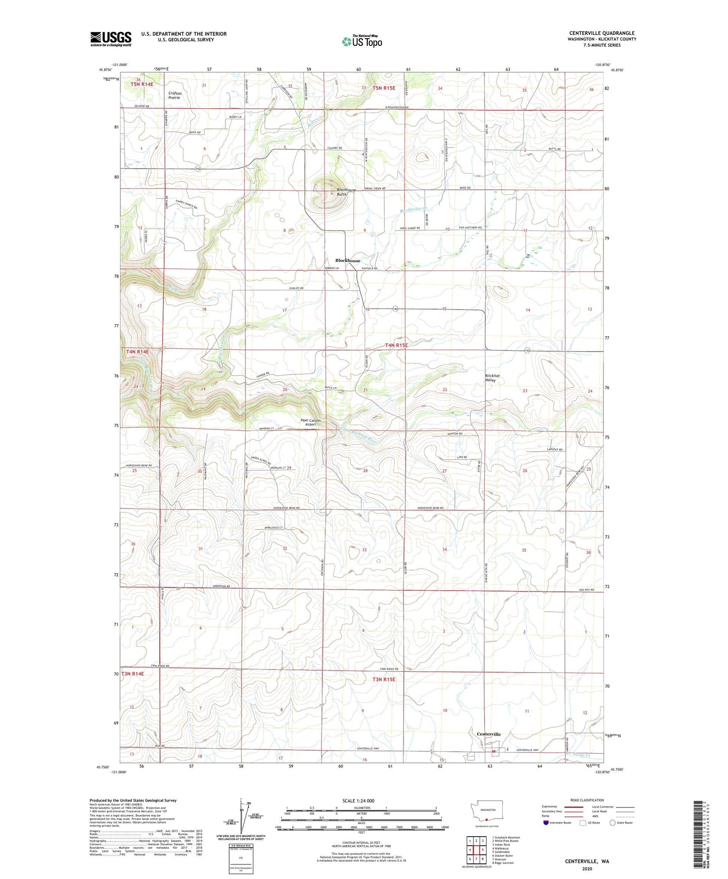
2023 topographic map quadrangle Centerville in the state of Washington. Scale: 1:24000. Based on the newly updated USGS 7.5' US Topo map series, this map is in the following counties: Klickitat. The map contains contour data, water features, and other items you are used to seeing on USGS maps, but also has updated roads and other features. This is the next generation of topographic maps. Printed on high-quality waterproof paper with UV fade-resistant inks.
Quads adjacent to this one:
West: Wahkiacus
Northwest: Grayback Mountain
North: White Pine Buttes
Northeast: Indian Rock
East: Goldendale
Southeast: Biggs Junction
South: Wishram
Southwest: Stacker Butte
This map covers the same area as the classic USGS quad with code o45120g8.
Contains the following named places: Blockhouse, Blockhouse Butte, Blockhouse Creek, Centerville, Centerville Census Designated Place, Centerville Elementary School, Crofton Prairie, Goldendale Trout Hatchery, Klickitat County Fire Protection District 5, Klickitat Valley, Piper Canyon Airport, Schilling Dam