MyTopo
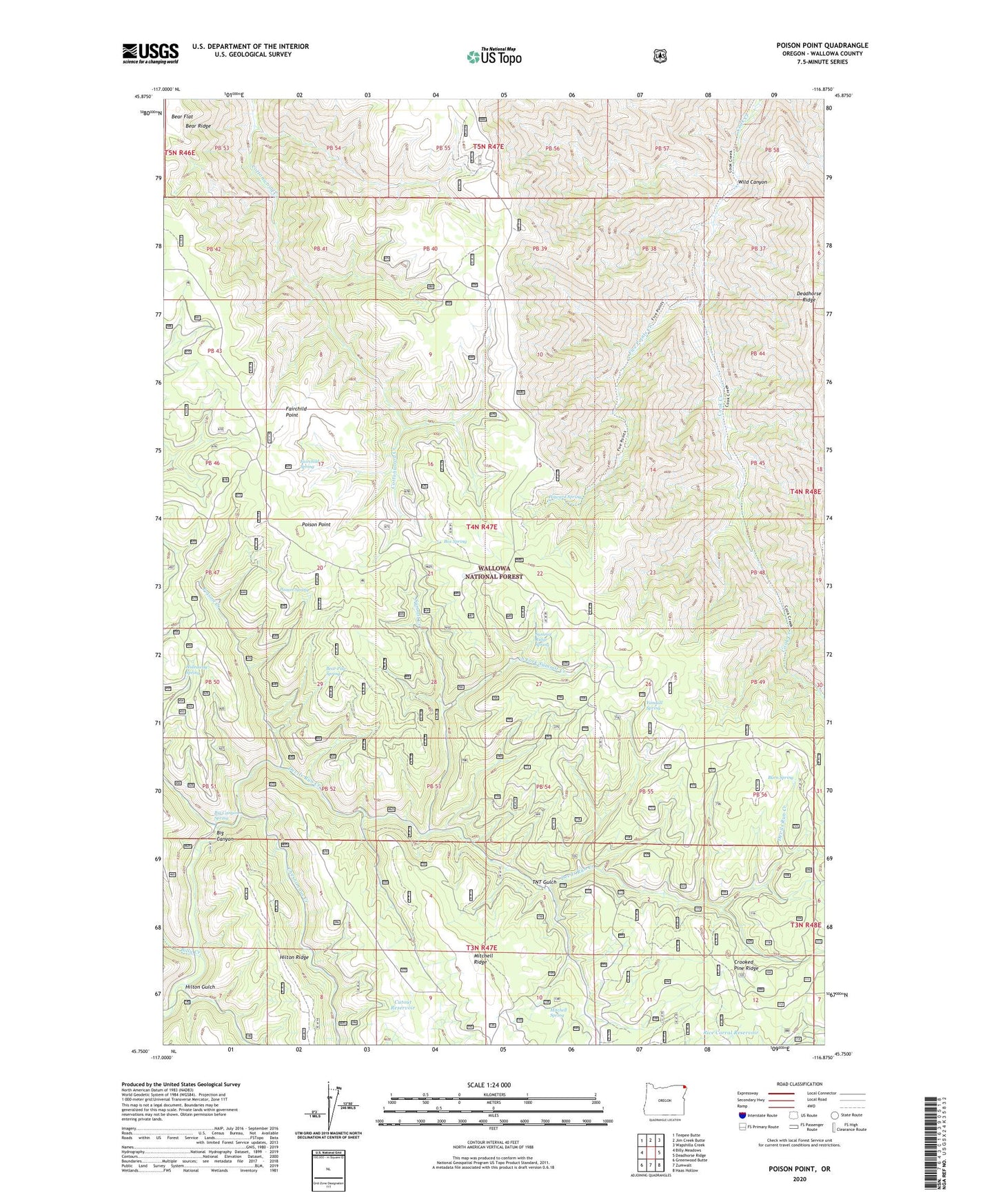
Poison Point Oregon US Topo Map
Couldn't load pickup availability
Also explore the Poison Point Forest Service Topo of this same quad for updated USFS data
2023 topographic map quadrangle Poison Point in the state of Oregon. Scale: 1:24000. Based on the newly updated USGS 7.5' US Topo map series, this map is in the following counties: Wallowa. The map contains contour data, water features, and other items you are used to seeing on USGS maps, but also has updated roads and other features. This is the next generation of topographic maps. Printed on high-quality waterproof paper with UV fade-resistant inks.
Quads adjacent to this one:
West: Billy Meadows
Northwest: Teepee Butte
North: Jim Creek Butte
Northeast: Wapshilla Creek
East: Deadhorse Ridge
Southeast: Haas Hollow
South: Zumwalt
Southwest: Greenwood Butte
This map covers the same area as the classic USGS quad with code o45116g8.
Contains the following named places: Bear Paw Spring, Bear Ridge, Big Canyon, Big Canyon Spring, Billy Creek, Box Spring, Burn Spring, Cook Creek Trail, Cottonwood Creek Trail, Crooked Pine Ridge, Cutout Reservoir, Devils Run Creek, Fairchild Point, Fairchild Spring, Five Points Creek, Hideaway Spring, Hilton Gulch, Hilton Ridge, Howard Cutoff Trail, Howard Spring, Mitchell Ridge, Mitchell Spring, Poison Creek, Poison Point, Poison Spring, Rice Corral Reservoir, South Fork Summit Creek, Summit Creek, Summit Ridge Spring, TNT Gulch, Wild Canyon, Yandall Spring