MyTopo
Bryant Mountain Oregon US Topo Map
Couldn't load pickup availability
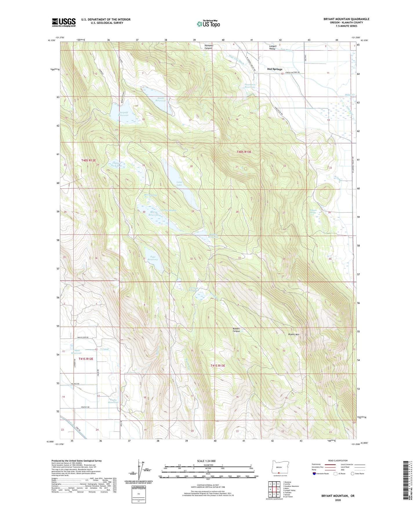
2020 topographic map quadrangle Bryant Mountain in the state of Oregon. Scale: 1:24000. Based on the newly updated USGS 7.5' US Topo map series, this map is in the following counties: Klamath. The map contains contour data, water features, and other items you are used to seeing on USGS maps, but also has updated roads and other features. This is the next generation of topographic maps. Printed on high-quality waterproof paper with UV fade-resistant inks.
Quads adjacent to this one:
West: Malin
Northwest: Bonanza
North: Lorella
Northeast: Goodlow Mountain
East: Langell Valley
Southeast: Carr Butte
South: Newell
Southwest: Tulelake
Contains the following named places: Bryant Mountain, Capek Reservoir, Captain Jack Lake, Dearborn Reservoir, Fivemile Reservoir, Grohs Reservoir, Gulch Dam, Hamaker Canyon, Harpold Reservoir, Hot Springs, Lone Pine Reservoir, Long Lake, McCoy Dam, McCoy Reservoir, McCoy Spring, Miller Creek, Mills Creek, Pope Reservoir, Ralston Spring, Smith Dam, Smith Reservoir, Tule Lake, Tule Lake Post Office, West Canal, Wooden Creek, Worlow Dam, Worlow Meadow, Worlow Reservoir