MyTopo
Goodlow Mountain Oregon US Topo Map
Couldn't load pickup availability
Also explore the Goodlow Mountain Forest Service Topo of this same quad for updated USFS data
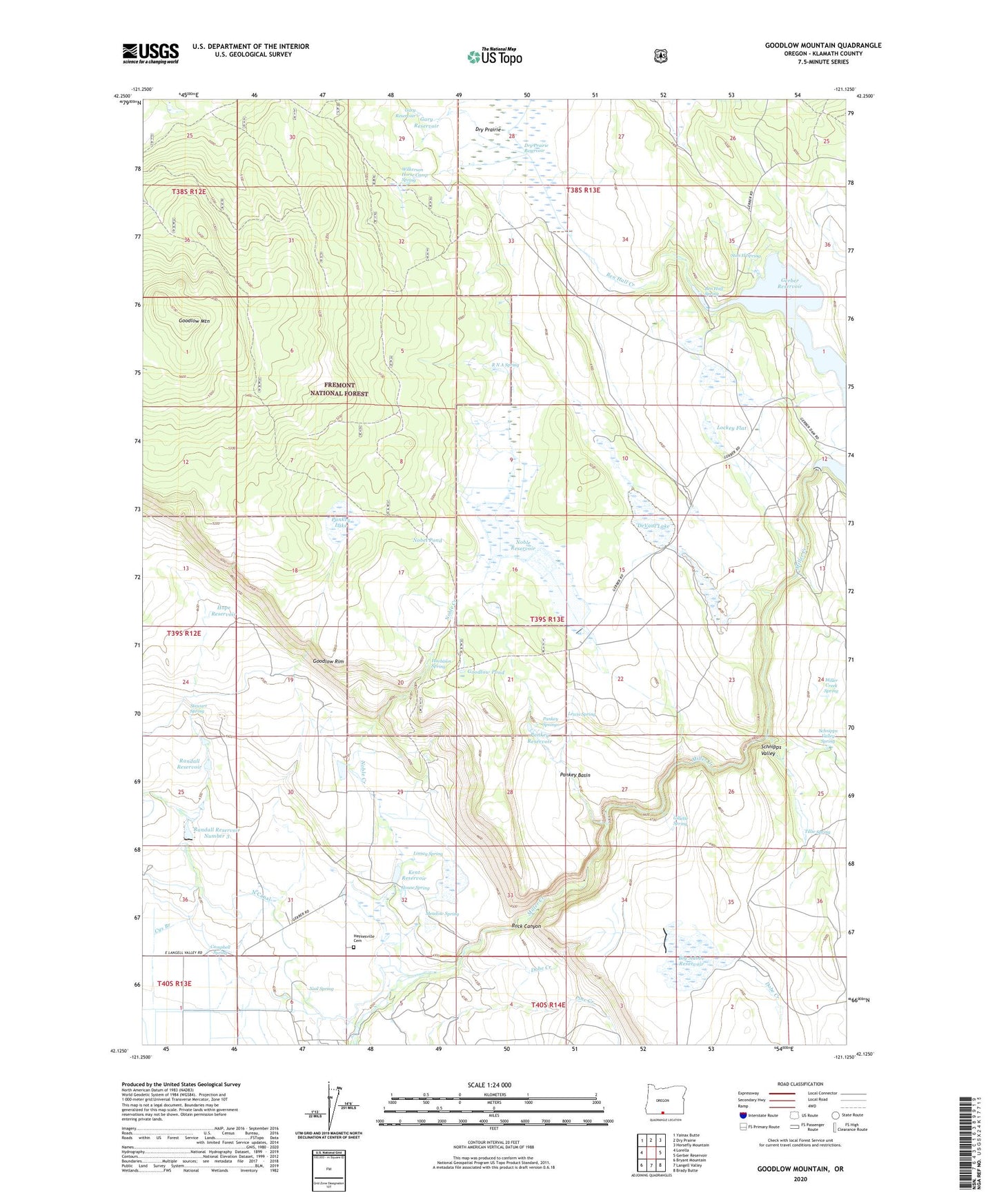
2024 topographic map quadrangle Goodlow Mountain in the state of Oregon. Scale: 1:24000. Based on the newly updated USGS 7.5' US Topo map series, this map is in the following counties: Klamath. The map contains contour data, water features, and other items you are used to seeing on USGS maps, but also has updated roads and other features. This is the next generation of topographic maps. Printed on high-quality waterproof paper with UV fade-resistant inks.
Quads adjacent to this one:
West: Lorella
Northwest: Yainax Butte
North: Dry Prairie
Northeast: Horsefly Mountain
East: Gerber Reservoir
Southeast: Brady Butte
South: Langell Valley
Southwest: Bryant Mountain
This map covers the same area as the classic USGS quad with code o42121b2.
Contains the following named places: Ben Hall Creek, Ben Hall Spring, Bieler Ranch, Big Adobe Dam, Big Adobe Reservoir, Campbell Spring, Cys Branch, DeVaul Lake, Dobe Creek, Dry Prairie Dam, Gary Reservoir, Gerber Dam, Gerber Reservoir North Recreation Site, Gerber Reservoir South Recreation Site, Gillette Spring, Glover Ranch, Goodlow Mountain, Goodlow Mountain Research Natural Area, Goodlow Pond, Goodlow Rim, Harbison Spring, Haynesville, Haynesville Cemetery, Hope Reservoir, House Spring, Johnson Ranch, Kent Reservoir, Lewis Spring, Linsay Spring, Lockey Flat, Meadow Spring, Miller Creek Camp, Miller Creek Spring, Miller Diversion Dam, Nail Spring, Nobel Pond, Noble Creek, Noble Ranch, Noble Reservoir, Noble Reservoir Number One, North Gerber Campground Boat Ramp, Pankey Basin, Pankey Lake, Pankey Ranch, Pankey Reservoir, Pankey Springs, Potholes Recreation Site, R N A Spring, Randall Dam Number 3, Randall Reservoir Number 3, Rock Canyon, Schnipps Valley, Schnipps Valley Spring, Stan H Spring, Stan H Spring Recreation Site, Stewart Spring, Tillie Spring, Wilkerson Horse Camp Spring