MyTopo
Langell Valley Oregon US Topo Map
Couldn't load pickup availability
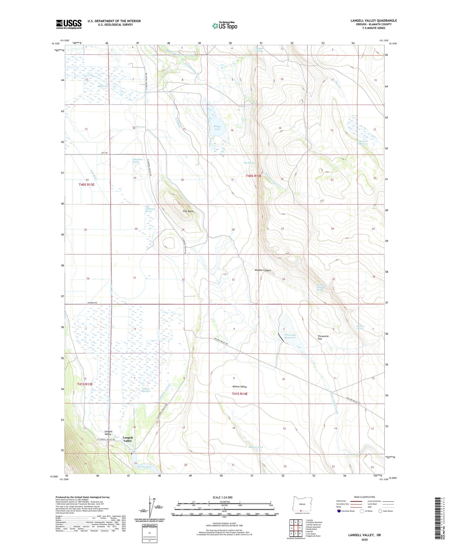
2023 topographic map quadrangle Langell Valley in the state of Oregon. Scale: 1:24000. Based on the newly updated USGS 7.5' US Topo map series, this map is in the following counties: Klamath. The map contains contour data, water features, and other items you are used to seeing on USGS maps, but also has updated roads and other features. This is the next generation of topographic maps. Printed on high-quality waterproof paper with UV fade-resistant inks.
Quads adjacent to this one:
West: Bryant Mountain
Northwest: Lorella
North: Goodlow Mountain
Northeast: Gerber Reservoir
East: Brady Butte
Southeast: Sagebrush Butte
South: Carr Butte
Southwest: Newell
This map covers the same area as the classic USGS quad with code o42121a2.
Contains the following named places: Black Canyon Creek, Boggs Lake, Copeland Reservoir, Dry Spring, East Lateral, East Malone Lateral, Gift Butte, Hargadine Spring, Heffner Spring, Kilgore Spring, Langell Valley, Langell Valley Post Office, Malone Dam, Pine Creek, Pre-exemption Spring, Rattlesnake Creek, Sullivan Spring, Threemile Dam, Threemile Flat, Threemile Reservoir, Willow Valley, Willow Valley Canal, Woolen Canyon, Woolen Canyon Spring