
MyTopo
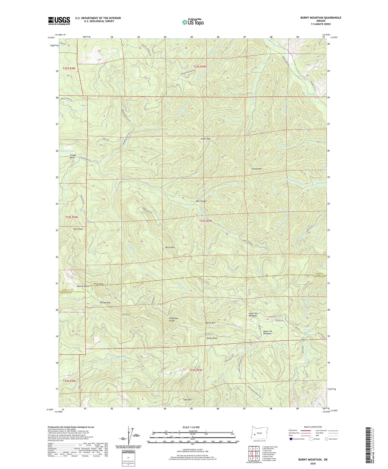
Burnt Mountain Oregon US Topo Map
Couldn't load pickup availability
2020 topographic map quadrangle Burnt Mountain in the state of Oregon. Scale: 1:24000. Based on the newly updated USGS 7.5' US Topo map series, this map is in the following counties: Lane, Douglas. The map contains contour data, water features, and other items you are used to seeing on USGS maps, but also has updated roads and other features. This is the next generation of topographic maps. Printed on high-quality waterproof paper with UV fade-resistant inks.
Quads adjacent to this one:
West: Harness Mountain
Northwest: Cottage Grove Lake
North: Blue Mountain
Northeast: Culp Creek
East: Silica Mountain
Southeast: Scaredman Creek
South: Harrington Creek
Southwest: Hinkle Creek
Contains the following named places: Bark Shanty Creek, Big Dry Creek, Boulder Creek, Box Canyon, Burnt Mountain, Cougar Bend, Dahl Creek, Edwards Creek, Fawn Peak, Grassy Mountain, Green Mountain, Huckleberry Spring, Kellys Bluff, Little Dry Creek, Lower Elk Meadows, Marion Butte, Middle Fork Stell Creek, Middle Mountain, North Fork Brownie Creek, Pilot Rock, Rock Creek Trail, Shirley Gap, Shirley Gap Lookout, South Fork Brownie Creek, South Fork Stell Creek, Upper Elk Meadows


