MyTopo
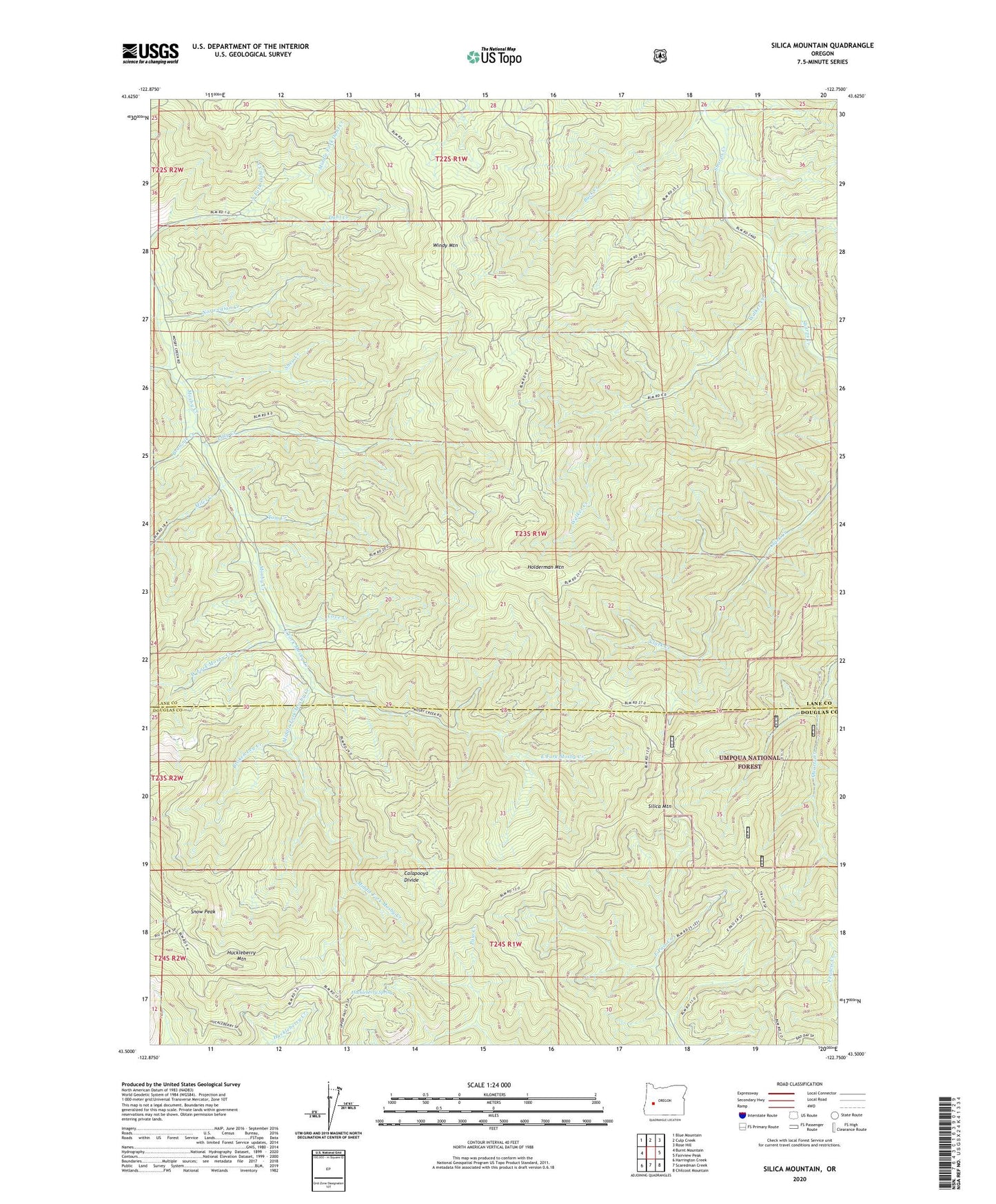
Silica Mountain Oregon US Topo Map
Couldn't load pickup availability
Also explore the Silica Mountain Forest Service Topo of this same quad for updated USFS data
2024 topographic map quadrangle Silica Mountain in the state of Oregon. Scale: 1:24000. Based on the newly updated USGS 7.5' US Topo map series, this map is in the following counties: Lane, Douglas. The map contains contour data, water features, and other items you are used to seeing on USGS maps, but also has updated roads and other features. This is the next generation of topographic maps. Printed on high-quality waterproof paper with UV fade-resistant inks.
Quads adjacent to this one:
West: Burnt Mountain
Northwest: Blue Mountain
North: Culp Creek
Northeast: Rose Hill
East: Fairview Peak
Southeast: Chilcoot Mountain
South: Scaredman Creek
Southwest: Harrington Creek
This map covers the same area as the classic USGS quad with code o43122e7.
Contains the following named places: Broken Leg Creek, Brownie Creek, Buck Creek, Cove Creek, East Fork Mosby Creek, Gray Creek, Holderman Mountain, Huckleberry Mountain, Huckleberry Spring, Lick Creek, Lilly Creek, Middle Fork Dahl Creek, Middle Fork Mosby Creek, Miles Creek, North Fork Dahl Creek, Norwegian Creek, Pass Creek Trail, Shea Creek, Silica Camp, Silica Mountain, Silica Trail, Snow Peak, Tom Creek, Tones Creek, Walker Creek, West Fork Mosby Creek, White Creek, Windy Mountain